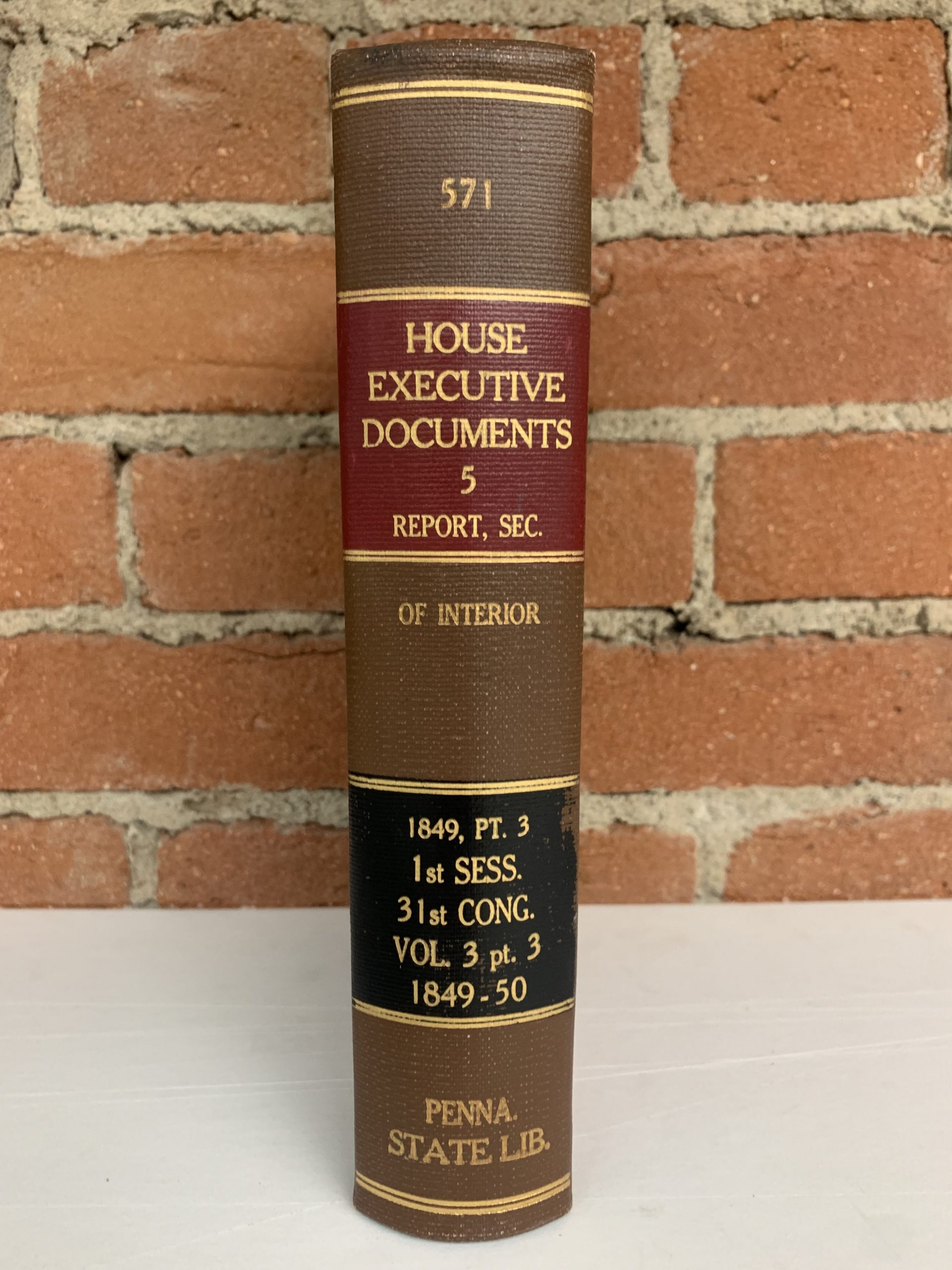
Report on the Geological and Mineralogical lands of the State of Michigan Commencement of the First Session of the Thirty-first Congress Ex Doc 5 Part III
In stock
This is an extensive and information report on the geological and mineralogical survey of the mineral lands in Michigan lying South of Lake Superior and North and Northwest of Lake Michigan. The purpose of the survey was to determine which lands should be classified “mineral lands” and which “agricultural lands”. Included in the congressional mandate was a provision for the establishment of a General Land Office in the Northern part of Michigan to manage the sale of the state’s mineral lands. Jackson spent two seasons on this project and then resigned. The work was completed by two of his assistants, J.D. Whitney and J.W. Foster. It contains four small plans and the following five hand colored geological maps:
1) Geological Map of Isle Royale Lake Superior, Michigan Foster and Whitney. (25 x 17.5″).
2) Geological Map of Keweenaw Point, Lake Superior by Jackson. (22.5 x 13.5″). Disbound.
3) Geological Map of Keweenaw Point, Lake Superior by Foster and Whitney. (20.5 x 10.6″).
4) Geological Map of the District between Keweenaw Bay and Chocolate River by Foster and Whitney. (24 x 19″).
5) Geological Map of the District between Portage Lake and Montreal River, Lake Superior, Michigan by Foster and Whitney. (29.5 x 15.4″). Misfolded.
An additional five uncolored maps listed as follows:
6) Geological Map of Townships in the Northern Peninsula of Michigan (10 x 9″).
7) Geological Map of a District of Township Lines of Michigan by W.A. Burt (11.5 x 9.8″).
8) Geological Map of Township Lines in the Northern Peninsula of Michigan by W.A. Burt (10.4 x 7″).
9) Geological Map of a District E & W of the Ontonagon by Higgins & Hubbard (17.4 x 9.8″).
10) Geological Map of the District Subdivided By the Messrs. Hubbard & Ives (15.3 x 7.8″)
Complete volume with 935 pages, 3rdvo.
Dimensions: 6 x 9.25 inches
Pages: 935
Condition: Very good condition, pages are intact and print is clear and bright. There is slight age toning. Maps are in very good condition with slight age toning.
Original Production Year: 1849
Year: 1849
In stock


