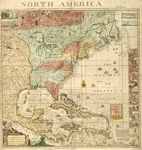
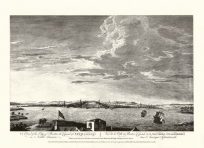
This exquisite 1733 map by Henry Popple shows the British Empire in America alongside French and Spanish establishments. This highly-detailed map shows Native American settlements, the Great Lakes, the Appalachian Mountains, and the territory west of the Mississippi River. It identifies Savannah, St. Augustine, Charleston, Jamestown, Chesapeake Bay, Little Egg, Long Island, and Boston. Near the Caribbean, the map shows Cuba, Jamaica, Puerto Rico, and the Bahama Islands. An illustration of pirates and treasure rests near the cartouche near Guatemala and Costa Rica. In South America, the map shows the Honduras, New Granada, which corresponds to present-day Colombia, Ecuador, Panama, and Venezuela. In the inset, the map captures Boston, New York, Bermuda, Providence, and Porto Bello.
Additional information
| Weight | 0.25 lbs |
|---|---|
| Dimensions | 23 × 22 × 0.002 in |
Map Maker: Henry Popple
Original Production Year: 1733
Original Production Year: 1733


