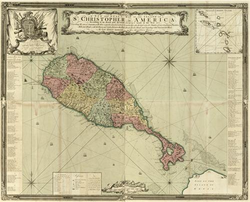
This hand colored map by Samuel Baker shows the island of St. Christopher in America, according to an actual and accurate survey made in the year 1753. St. Christopher Island is the formal French name for St. Kitt’s Island in the West Indies. The map describes the several parishes, with their respective limits, contents, & churches; also the highways, the situation of every gentleman’s plantation, mills, and houses; with the rivers, and gutts. Likewise the bays, roads, rocks, shoals and soundings that surround the whole. This map also shows a nice inset of the Leeward Caribbee Islands” which includes all of the islands in the area. “
Additional information
| Weight | 0.25 lbs |
|---|---|
| Dimensions | 34 × 42 × 0.002 in |
Map Maker: Lieutenant Samual Baker
Original Production Year: 1753
Original Production Year: 1753


