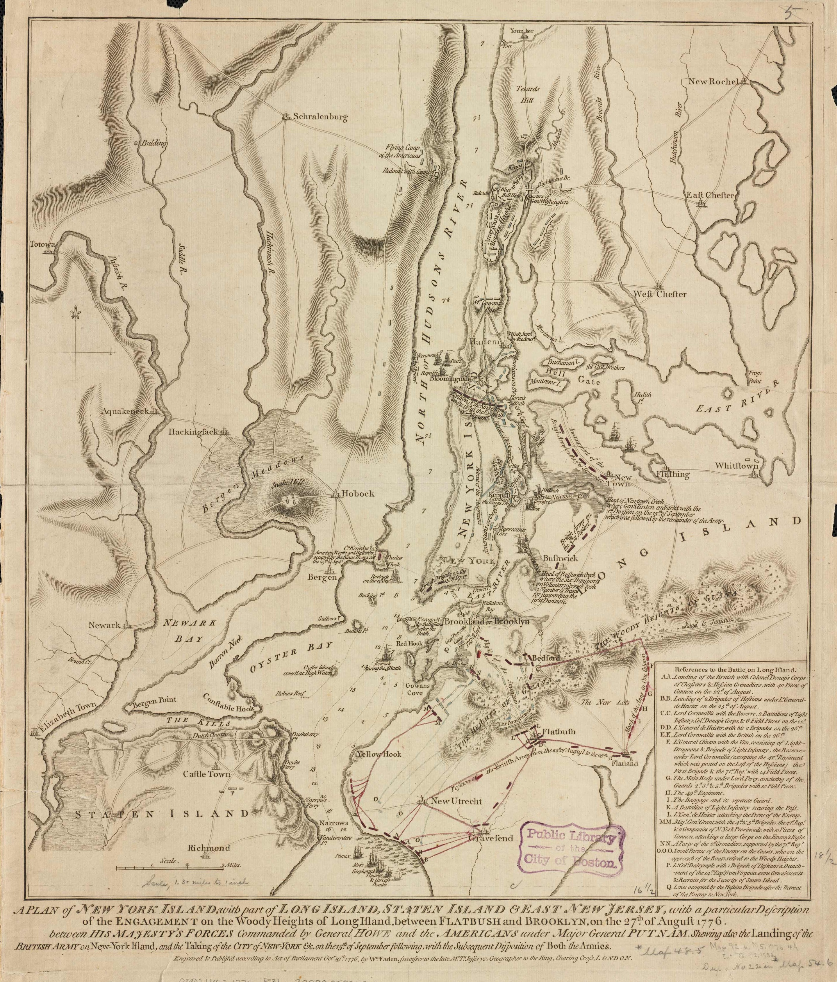
This map by William Fadden shows what happened during the Revolutionary War on August 27th, 1776. American forces are denoted in blue; British forces are in red. This map is unusual in that it includes text about what happened that day. The British, under General Howe, were planning to isolate New England to leave it defenseless. In June 1776, the British began establishing an armada in New York Bay. The British struck what is present-day Brooklyn with a force of 15,000 on August 22. However, Washington was able to take his troops by ferry to Manhattan during the night of August 29. Eventually, the British seized full control of Manhattan by November.Red lines provide details of batteries and interactions between American and British forces around Yellow Hook, Gowan’s Cove, and Flatbush. This map was published shortly after the Battle of Long Island and depicts roads, forts, and includes some topographical detail. An informative account for any Revolutionary War history buff!
Additional information
| Weight | 0.25 lbs |
|---|---|
| Dimensions | 25 × 22 × 0.002 in |
Map Maker: William Faden
Original Production Year: 1776
Original Production Year: 1776


