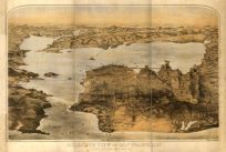
This is a breathtaking colonial map of the east coast, with definite historic and aesthetic appeal. There is so much to note about this map that is hard to begin. Aside from the exhaustive text (in German) that surrounds the map, there abound numerous historic notations on the map itself, as it shows us the bounds of the Treaty of Utrecht”, “The Limits of New England by charter 1620″ and others. Unique borders are found for numerous states such as New York, here shown stretching over the Great Lakes into present day Michigan. Likewise North Carolina, here spans across the its present borders and proceeds across the Mississippi River. Other uncommon boundaries are found for South Carolina, Florida, Virginia and more. Frontier forts, Indian tribes and settlements are shown. Numerous other desirable cartographic oddities appear such as the fictitious islands of Superior, Earl Granvilles property, amongst others.”
Additional information
| Weight | 0.25 lbs |
|---|---|
| Dimensions | 18.5 × 20 × 0.002 in |
Map Maker: Homann Heirs
Original Production Year: 1756
Original Production Year: 1756


