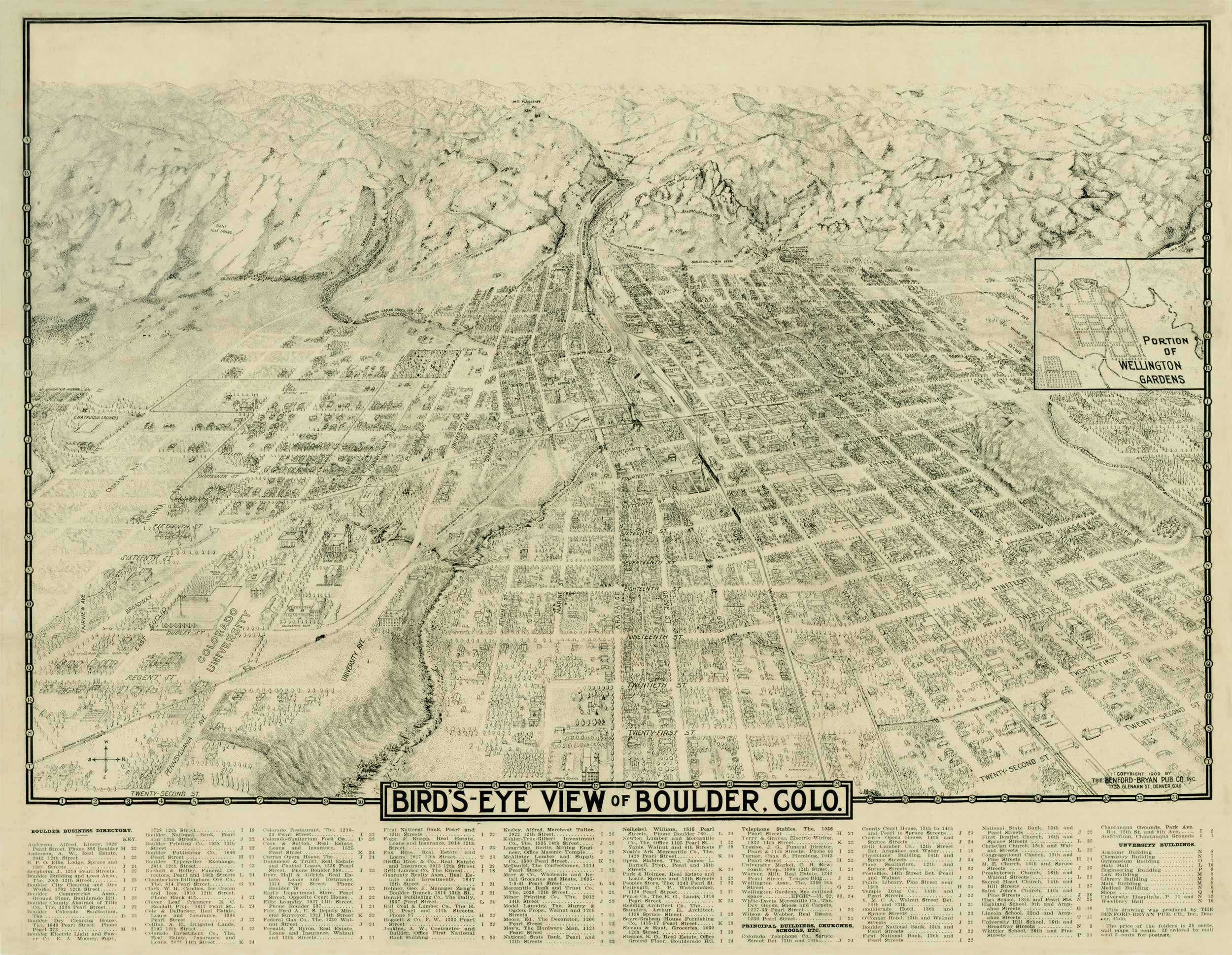
This detailed map of Boulder, Colorado was printed by Benford-Bryan Pub. Co. in 1909. This map includes a directory of all the businesses housed in Boulder at the time of print, as well as the University of Colorado Boulder and each of its buildings at that time. Most streets are identified as well as the railroad which runs through the town, and recreational areas such as Chataqua Park and certain mountains and canyons across the foothills are included. There is an inset of a portion of the Wellington Gardens.


