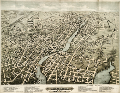
This view of Pawtucket and Central Falls in Rhode Island names up to 56 locations, including churches, banks, hotels, the Post Office, and numerous manufacturing buildings. The map also identifies neighborhoods, ponds, railroad lines, street names, and more. Buildings are indexed below. A very information-rich map of the then-bustling Central Falls & Pawtucket areas!
Additional information
| Weight | 0.25 lbs |
|---|---|
| Dimensions | 26 × 34 × 0.002 in |
Map Maker: O.H. Bailey & J.C. Hazen
Original Production Year: 1877
Original Production Year: 1877


