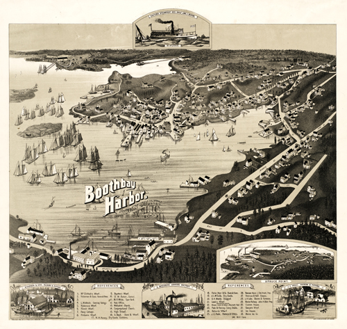
This breathtaking view of Boothbay Harbor, Maine shows the harbor as it was in 1885. The map shows locations of various churches, a pharmacy, a shoe store, ice house, grocery, cottages, and numerous wharves. In the inset, the map features the Eastern Steamboat’s line to Boston, Maddock’s Canning Factory, J.C. Poole.’s Packers & Fitters, and Nickerson & Son’s Packer and Fitters.
Additional information
| Weight | 0.25 lbs |
|---|---|
| Dimensions | 21 × 22 × 0.002 in |
Map Maker: A.F. Poole
Original Production Year: 1885
Original Production Year: 1885


