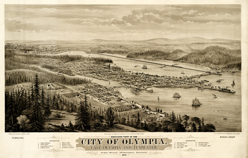
This overview of Olympia shows the town as it was in 1879. This map features neighborhood grids, street names, the Capital Building, churches, the Court House, Town Hall, and the Odd Fellows’ Hall. Building locations are indexed beneath the map. Railroad lines are also shown. Horse-drawn carriages traverse the streets as ships leave to and from the docks. The artist, himself, paints this map on an easel on a hill overlooking the location. A picturesque and informative piece for anyone!
Additional information
| Weight | 0.25 lbs |
|---|---|
| Dimensions | 22 × 34 × 0.002 in |
Map Maker: Glover, E. S.
Original Production Year: 1879
Original Production Year: 1879


