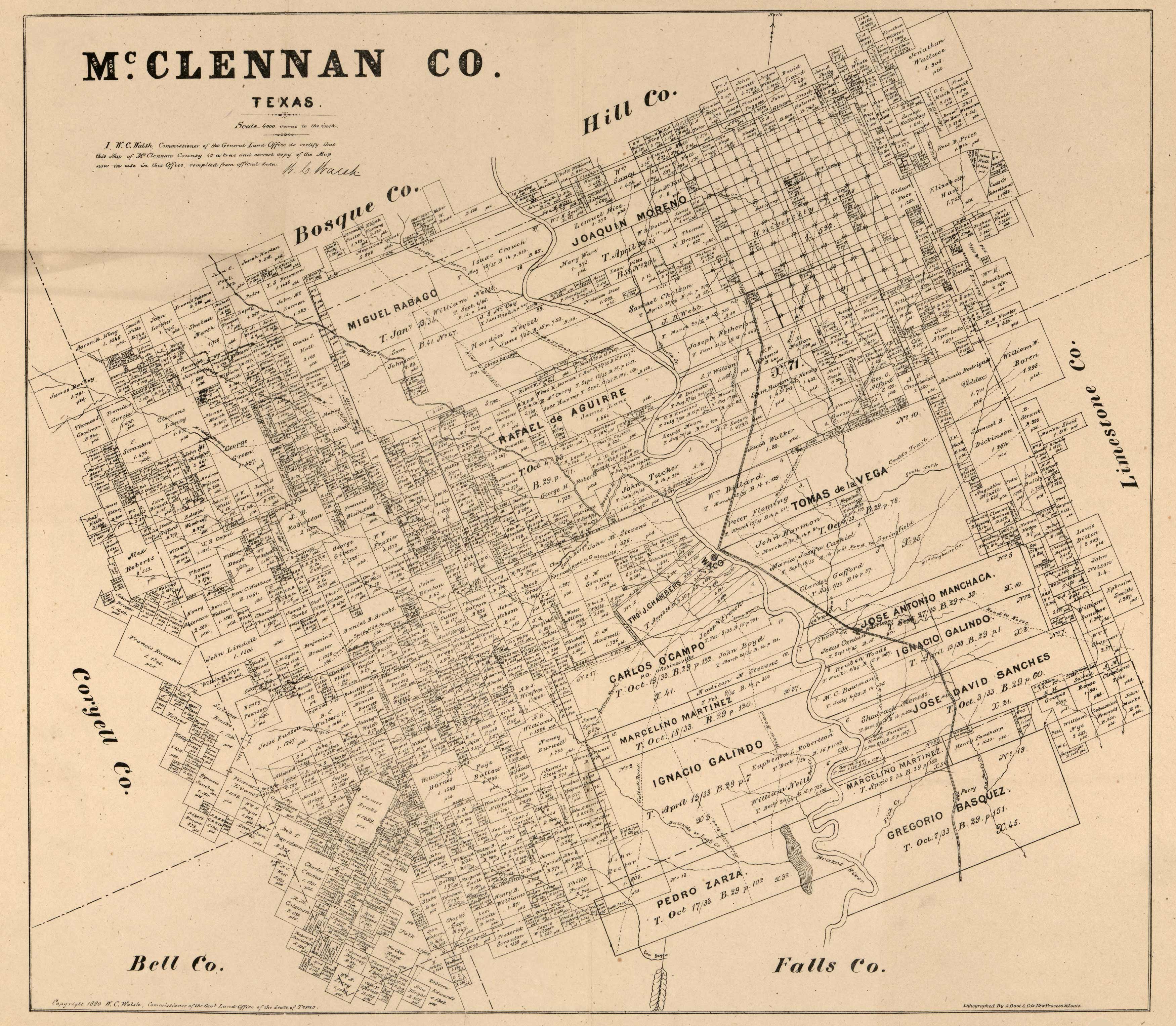
This is an extremely detailed land ownership map of McLennan County, Texas. This map does not show streets or landmarks, but it does label rivers and every single landowner in the county. It was done in 1880 by W.C. Walsh, Commissioner of the General Land Office of the State of Texas. It was lithographed by A. Gast & Company, St. Louis.


