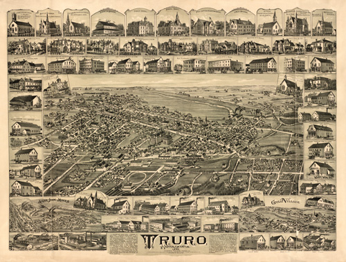
This map by Duncan D. Currie shows Truro, Nova Scotia as it was in 1889. The map identifies numerous streets, railroad lines, churches, factories, residences, clothing stores, pharmacies, booksellers, mines, hotels, and more. Up to 56 locations are named; the map contains over 30 insets of key area buildings. A very informative map!
Additional information
| Weight | 0.25 lbs |
|---|---|
| Dimensions | 20 × 27 × 0.002 in |
Map Maker: Currie, Duncan D.
Original Production Year: 1889
Original Production Year: 1889


