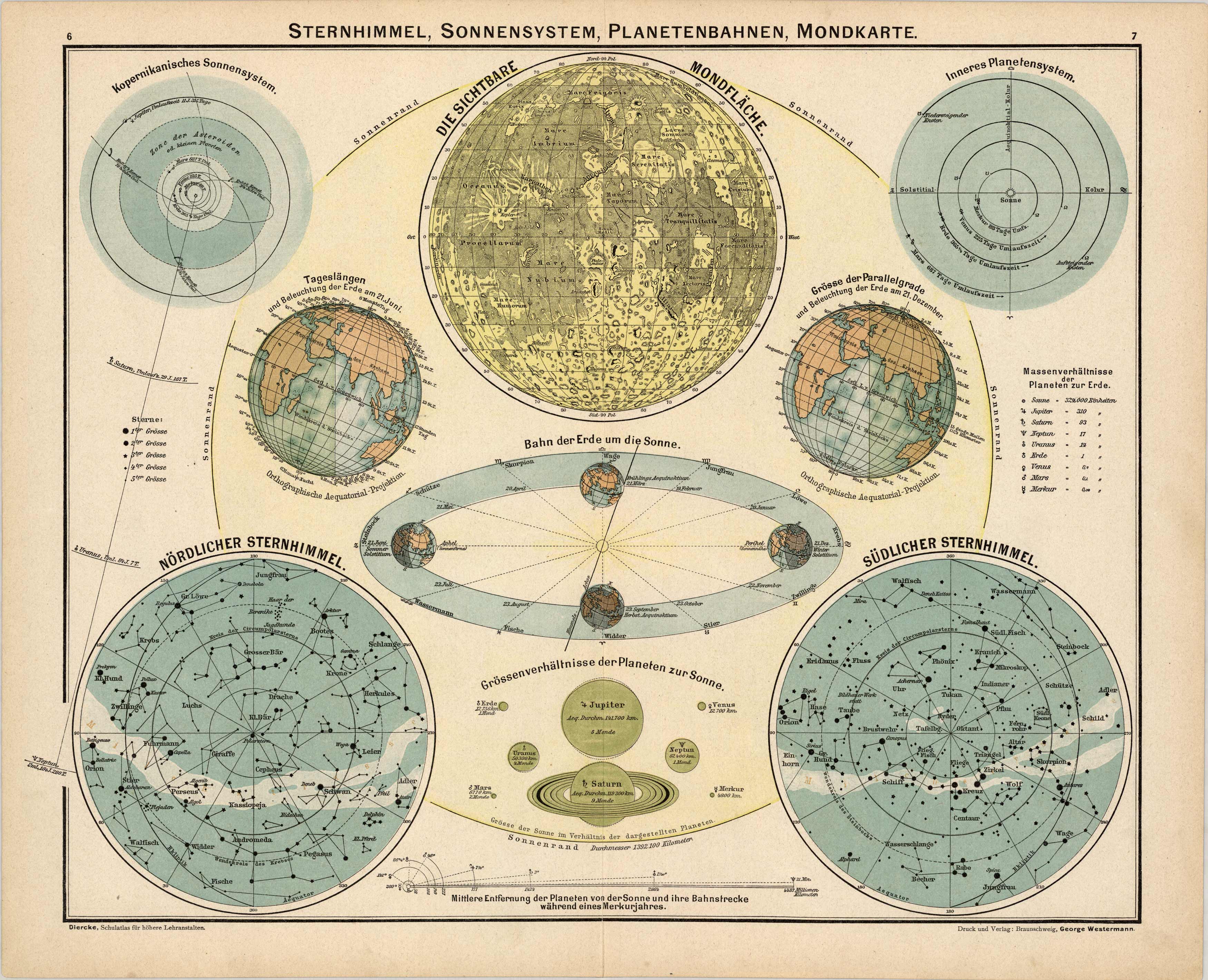
This map was produced for the 1902 Diercke, Schul-Atlas fur Hohere Lehranstalten, (Diercke Education Atlas for Higher Educational Institutions) This atlas was prepared and issued by C. Diercke and E.Gaebler for the Westermann publishing group in Braunschweig. With the help of fellow cartographer, Eduard Gaebler, Carl Dierckes maps became a staple in the geography classrooms in Germany. From 1893 until his death, Diercke was editor of all the maps for Westermann Verlag. All text is in German with full color that has remained quite bold. The original is a wonderful example of the fine German engraving work of the time. This map provides facts and information on the stars, solar system, orbits, moon, and sun. Details include the Copernican solar system, Northern and Southern night sky, Earth’s orbit around the sun, the visible surface of the moon, and size relationships of the planets to the Sun.
Additional information
| Weight | 0.25 lbs |
|---|---|
| Dimensions | 12 × 15 × 0.002 in |
Town Name: SOLAR SYSTEM, STARS, SUN, MOON
Map Maker: Carl Diercke, Eduard Gaebler
Year: 1902
Map Maker: Carl Diercke, Eduard Gaebler
Year: 1902


