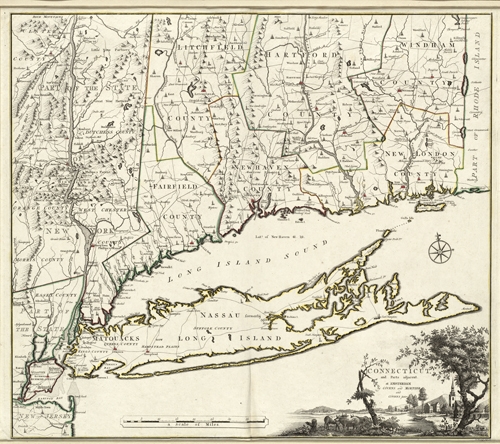
This 1780 map by Bernard Romans shows Long Island, New York and parts of Connecticut. It outlines counties, roads, and rivers. Some topographic information is shown along with the locations of Native American tribes. The map also shows Nassau Long Island Sound and Sandy Hook, New Jersey. In the corner, there’s an illustration of a river, a church, and a few farm animals resting underneath the shade of trees. Cartographic elements include a compass and scale.
Additional information
| Weight | 0.25 lbs |
|---|---|
| Dimensions | 22 × 25 × 0.002 in |
Map Maker: Bernard Romans
Original Production Year: 1780
Original Production Year: 1780


