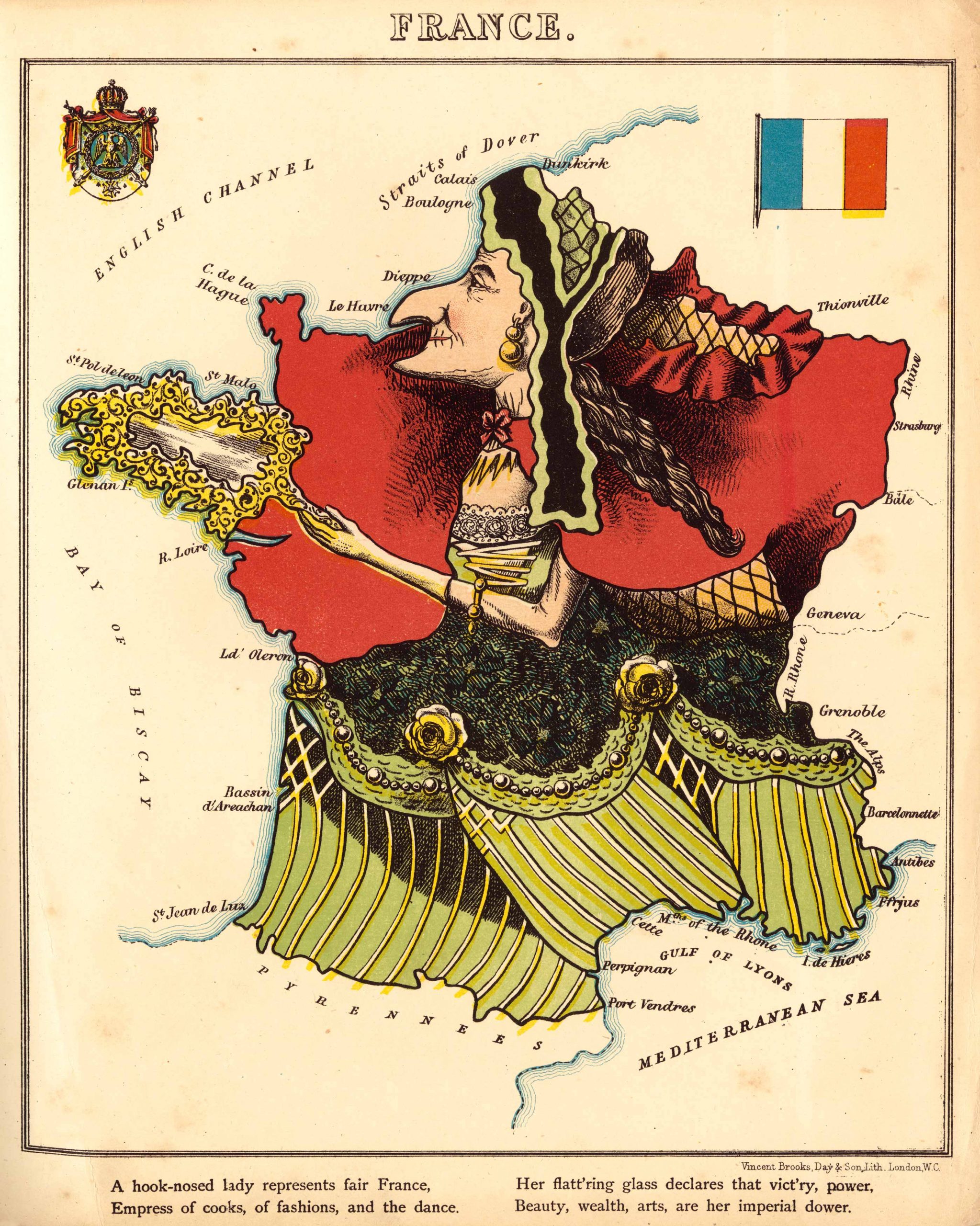
This 1868 map of France by Elizabeth Lancaster and William Harvey was originally published in Geographical Fun: Being Humourous Outlines of Various Countries.Drawn by a fifteen-year-old Victorian girl using the alias Aleph, the atlas contained twelve maps of European countries, each represented with a character and satirical verse. The book was created to help spur student interest in geography.
Additional information
| Weight | 0.25 lbs |
|---|---|
| Dimensions | 10.5 × 8 × 0.002 in |
Map Maker: Harvey, William; Lancaster, Elizabeth Lilian
Original Production Year: 1868
Original Production Year: 1868


