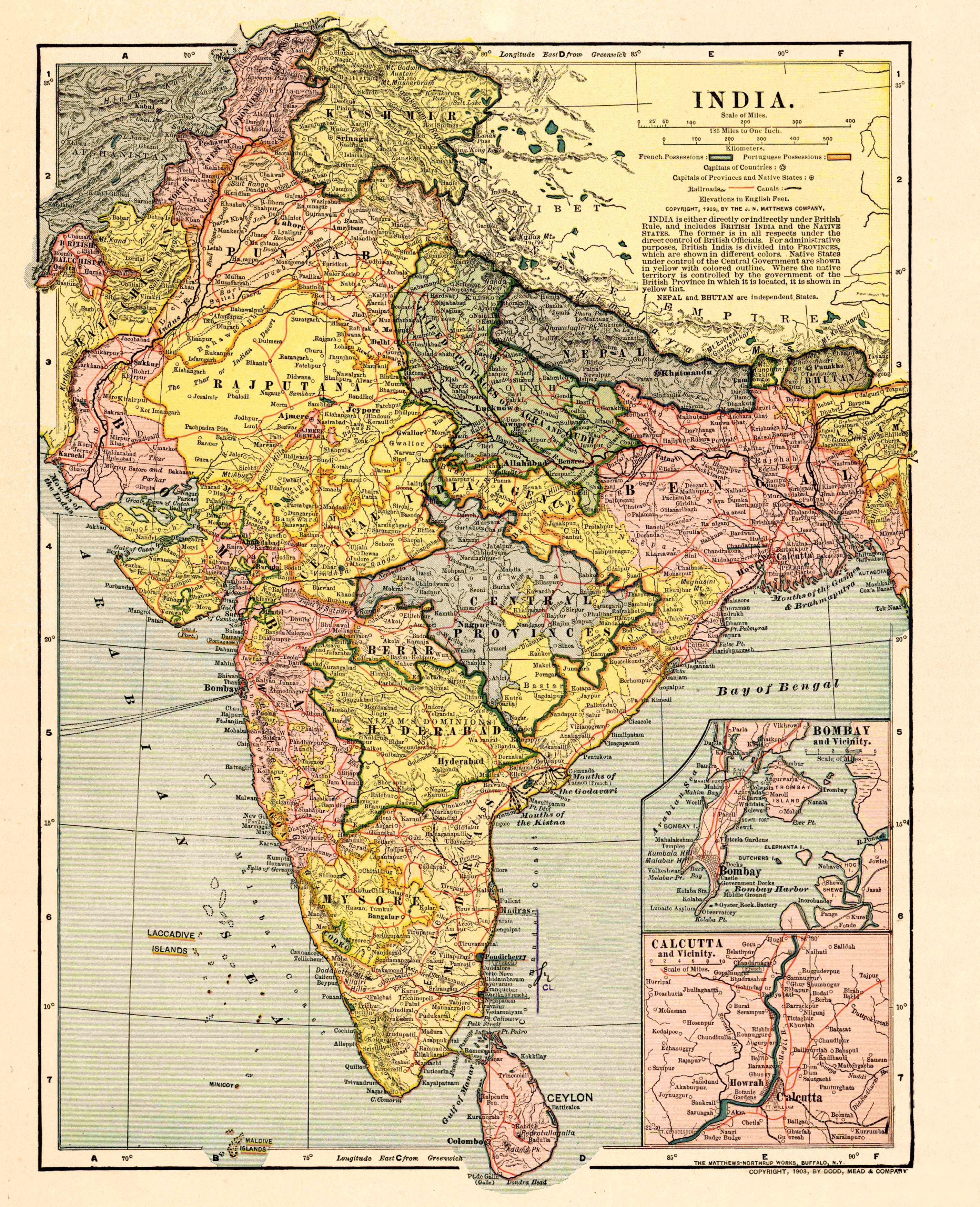
This 1903 map of India shows India under British Rule and the native states from before. Nepal and Bhutan are shown as independent states.This detailed map shows railroads, canals, French Possessions,Portuguese Possessions, the capitals of countries, and the capitals of provinces and native states. In the insets below, it shows Bombay and Calcutta. Beyond this, the map showsnumerous cities, mountain ranges, and bodies of water.
Additional information
| Weight | 0.25 lbs |
|---|---|
| Dimensions | 50 × 41 × 0.002 in |
Map Maker: Dodd, Mead & Company
Original Production Year: 1903
Original Production Year: 1903


