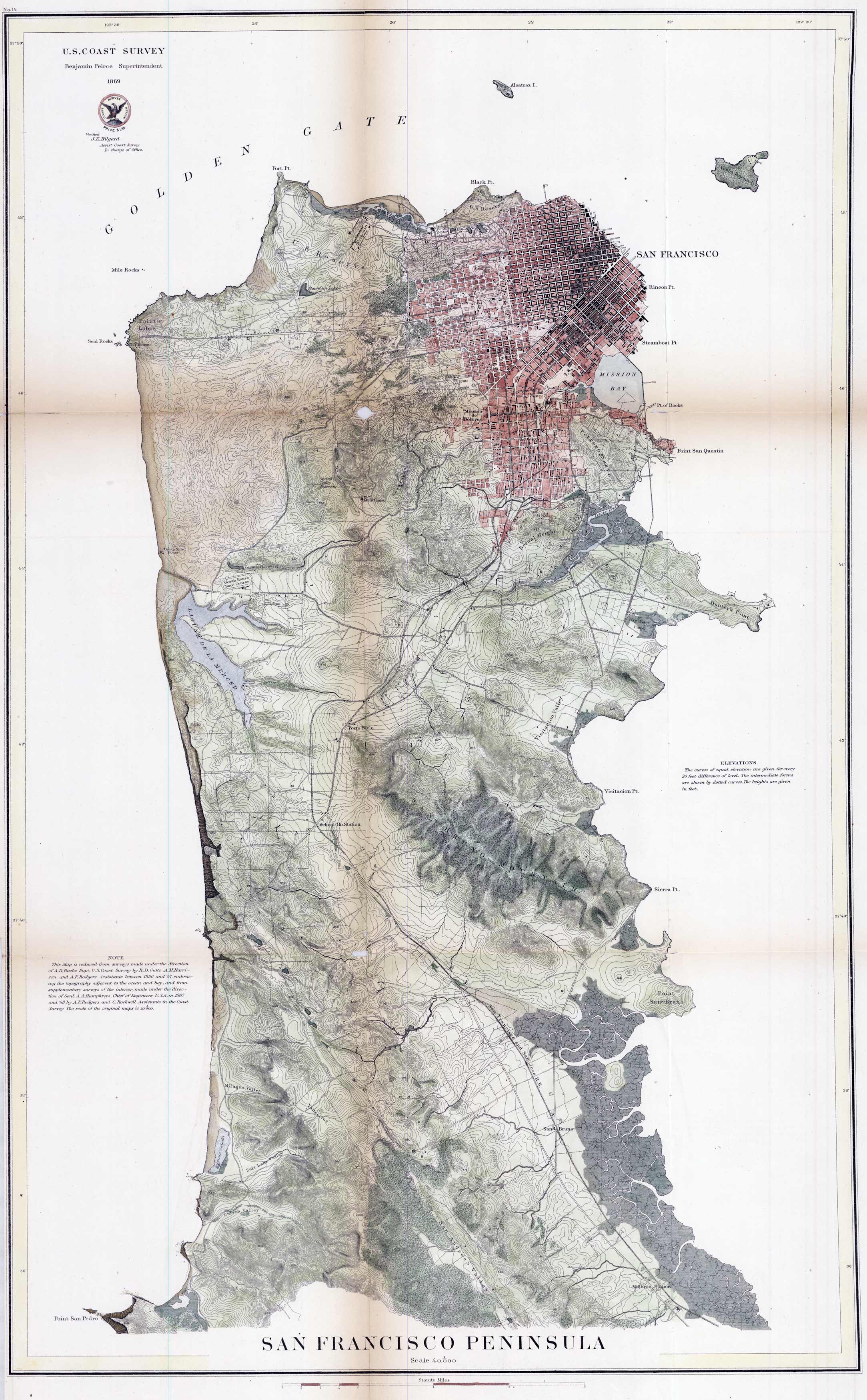
This fine 1869 U.S. Coast Survey of the San Francisco Peninsula shows topographical information of the area along with city grids, geographic data, U.S. reserve locations, cemetery locations, railroad lines, lakes, and more. It extends as far north as Golden Gate, Fort Point, and Alacatraz Island and as far south as Point San Pedro and the San Andreas Valley. This map has been archivally reinforced at the folds. Very hard to find in this condition.
Additional information
| Weight | 0.25 lbs |
|---|---|
| Dimensions | 29 × 18 × 0.002 in |
Town Name: SAN FRANCISCO
Map Maker: U.S. Coastal Survey
Year: 1869
Map Maker: U.S. Coastal Survey
Year: 1869


