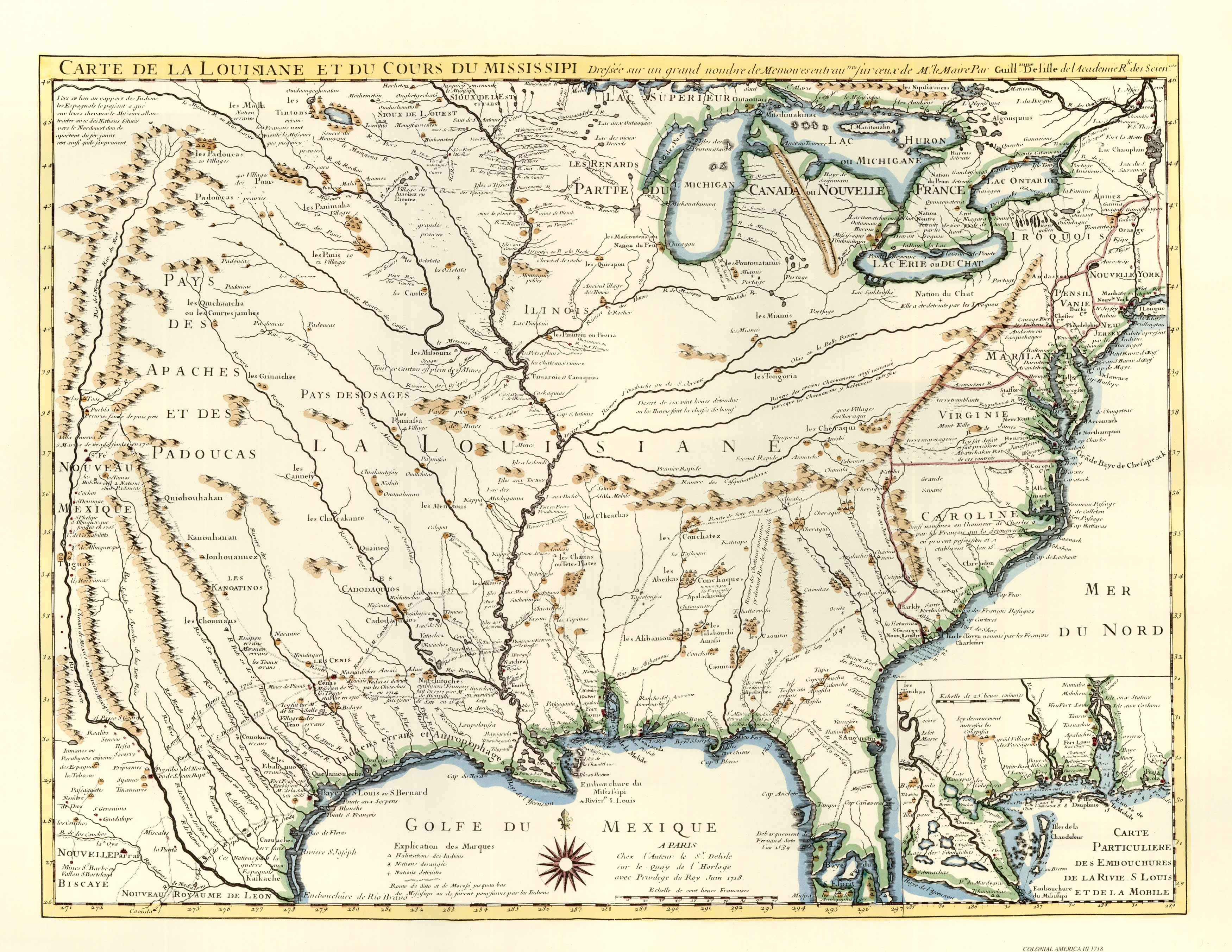
Delisle’s Louisane” is recognized by all historians of cartography as one of the most important maps of America. It was the first to use Texas as a plan-name, its depiction of the Mississippi valley is strikingly accurate, and it was the earliest map to show the routes of such early explorers as DeSoto, Cavelier, Tonty, and Denis.”
Additional information
| Weight | 0.25 lbs |
|---|---|
| Dimensions | 18.6 × 24 × 0.002 in |
Map Maker: Delisle
Original Production Year: 1718
Original Production Year: 1718


