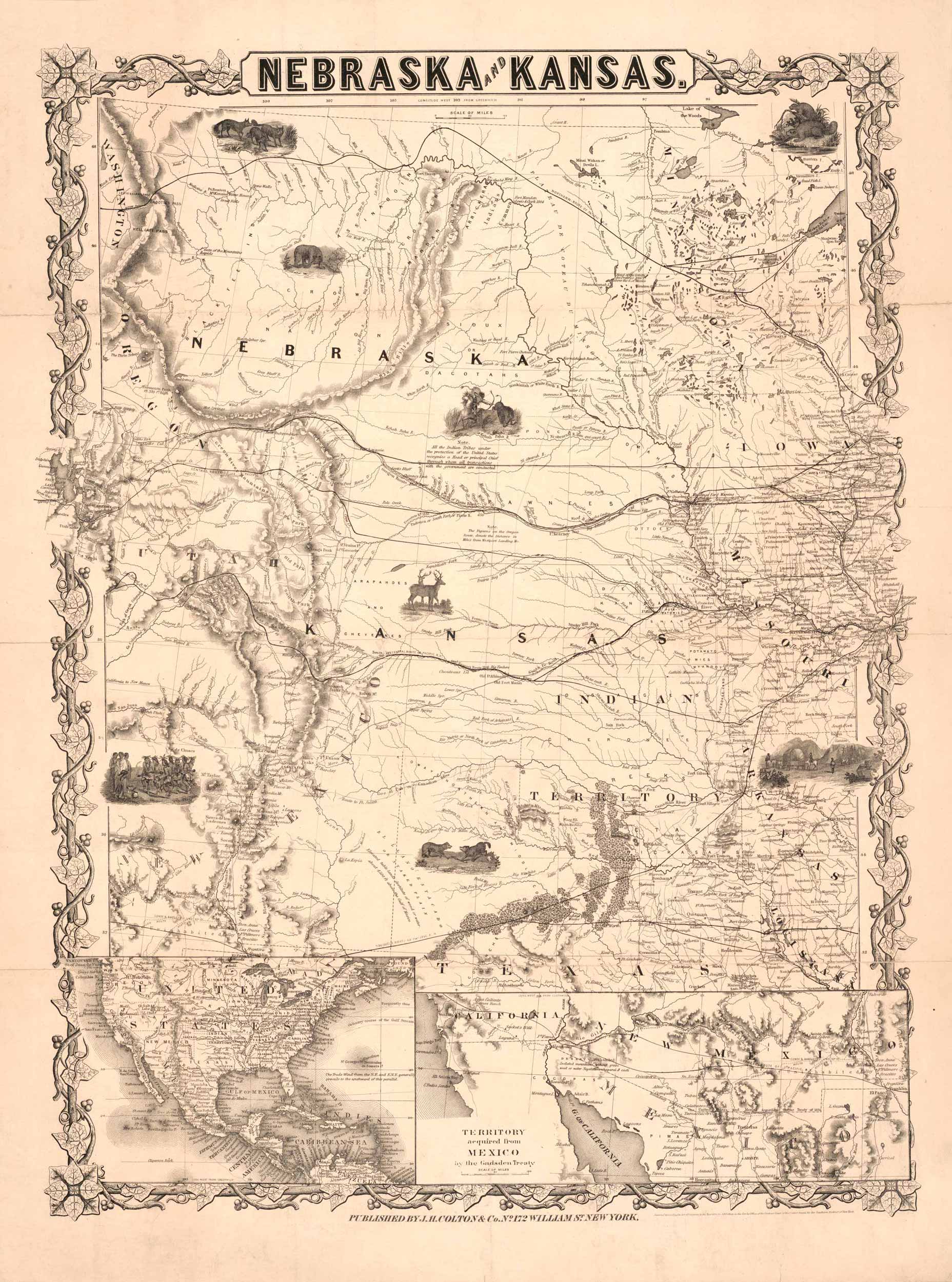
Nebraska and Kansas map that includes depictions of wildlife, Native American life, and settler life. The map was created in 1855 by J.H. Colton & Co. Includes one inset map of the United States and one inset map of the territory acquired from Mexico by the Gadsden Treaty.
Additional information
| Weight | .25 lbs |
|---|---|
| Dimensions | 20 × 15 × .002 in |
Map Maker: J.H. Colton & Co.
Original Production Year: 1855
Original Production Year: 1855


