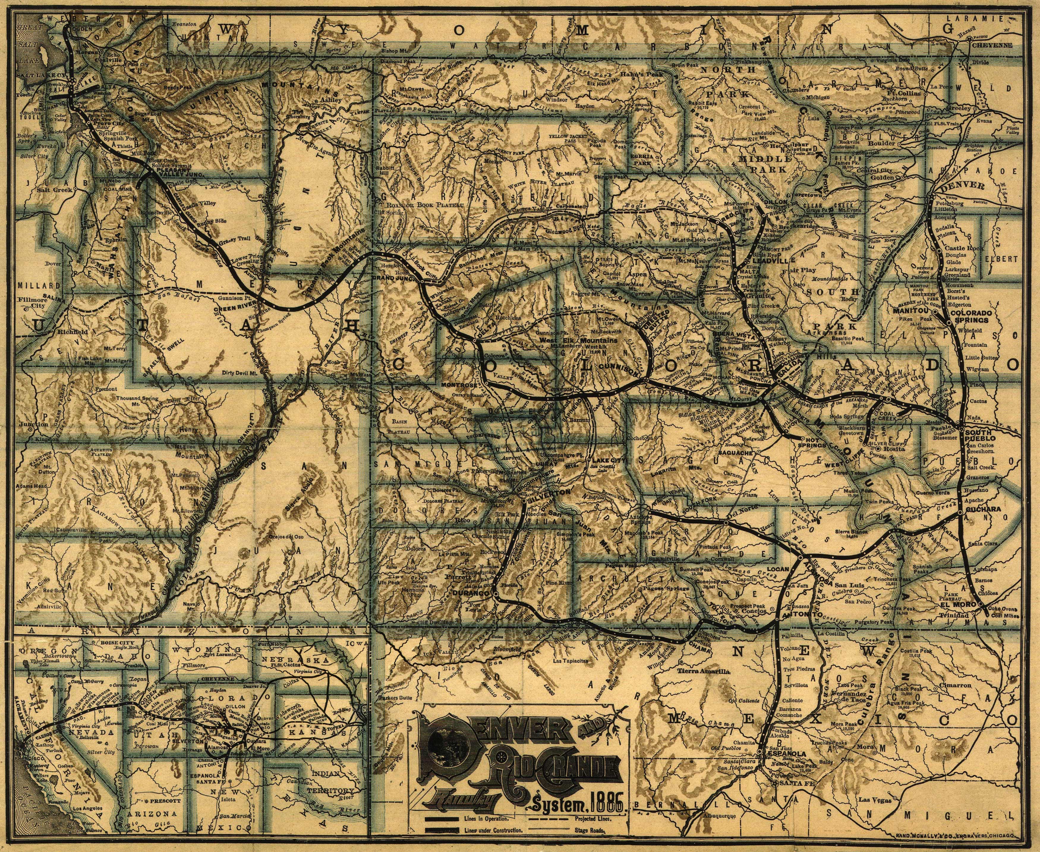
Map of Colorado and parts of New Mexico, Utah, and Arizona showing relief by hachures and shading, drainage, cities and towns, counties, stage roads, and railroads with the main line emphasized.
Additional information
| Weight | 0.25 lbs |
|---|---|
| Dimensions | 19.5 × 24 × 0.002 in |
Map Maker: Rand McNally and Company
Original Production Year: 1886
Original Production Year: 1886


