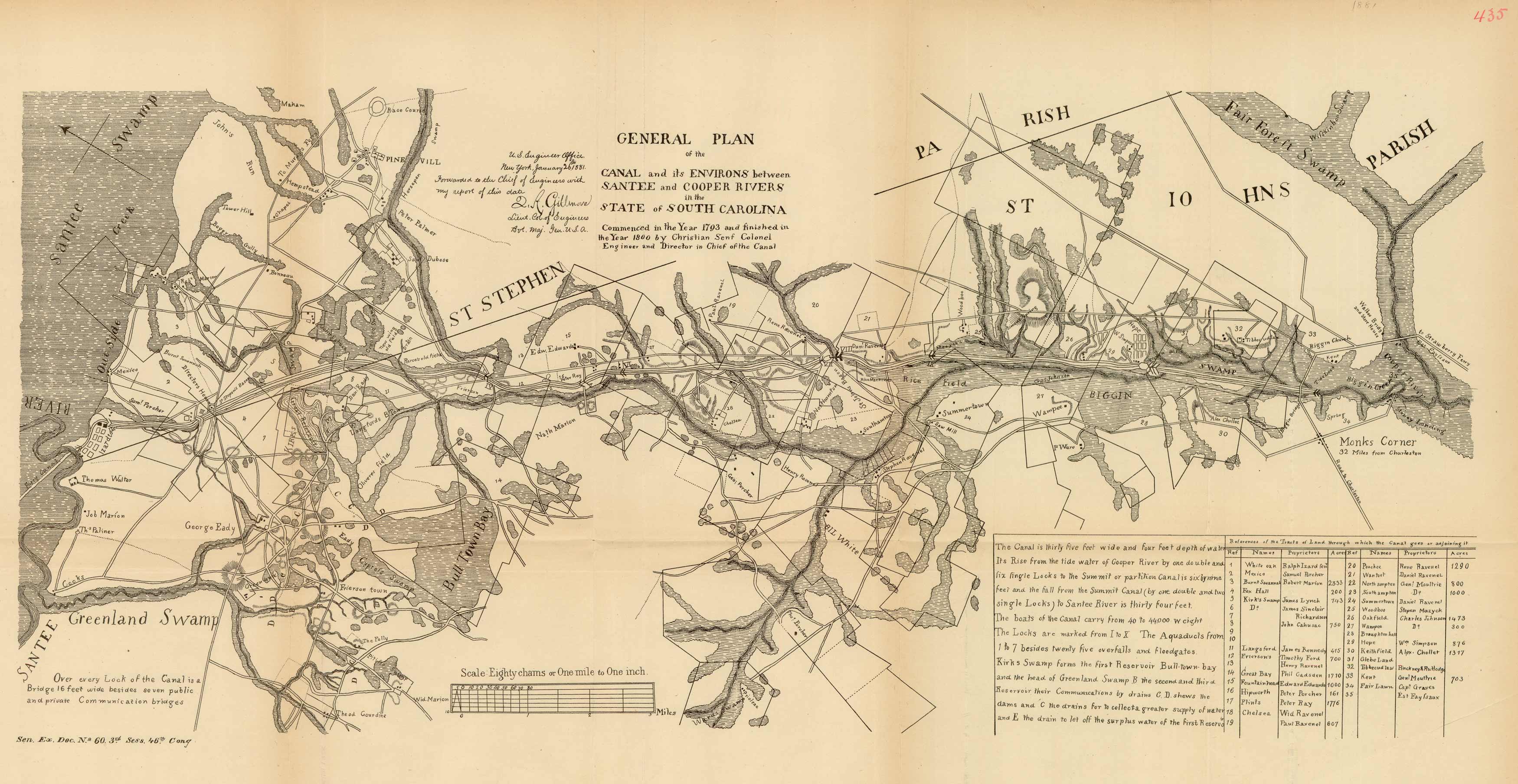
This map was part of an 1881 Senate Document on the Santee Canal. This map is a “general plan” of the canal (between the Santee and Copper Rivers in South Carolina). The map also has a chart with “references of the tracts of land through which the canal goes or adjoining it”.
Additional information
| Weight | 0.25 lbs |
|---|---|
| Dimensions | 10.5 × 23 × 0.002 in |
Town Name: SANTEE CANAL, SC
Map Maker: U.S. Government
Original Production Year: 1881
Year: 1881
Map Maker: U.S. Government
Original Production Year: 1881
Year: 1881


