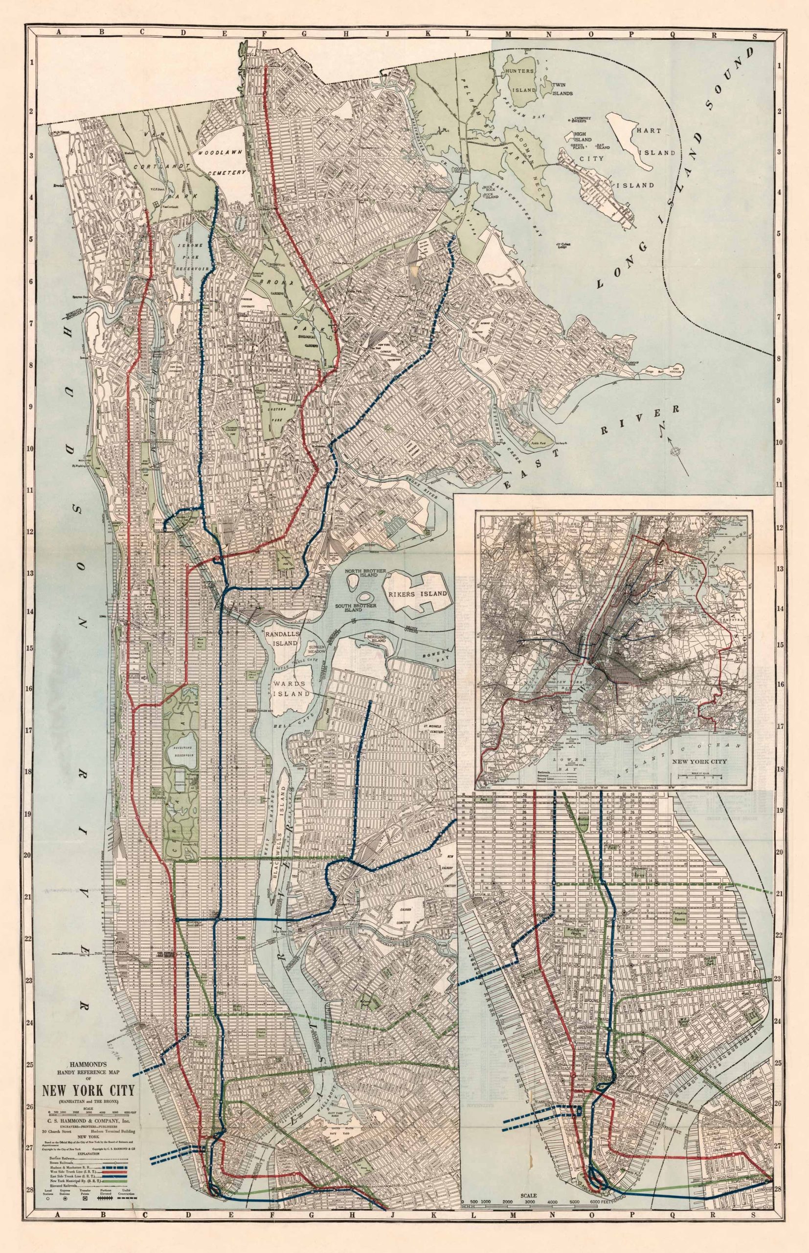
This map, Hammond’s Handy Reference Map of New York City (Manhattan & the Bronx) was published, printed and engraved by C.S. Hammond & Company Inc. 30 Church street, Hudson Terminal Building, New York. This map of the New York area features an explanation that features marks such as surface railways, steam railroads, Hudson and Manhattan R.R., and others. This map also features an enlarged inset of New York City showing primarily Manhattan, the Lower Bay, and the Atlantic Ocean. Also featured on the map is Randall’s Island, Wards Island, Riker’s Island, North Brother Island, South Brother Island, the East River, Long Island Sound, Hart Island, and the Hudson River. This map was published in 1921 and is beautiful and vibrant. This is a perfect map for anyone with a love of New York City in the 1920’s, or who wants to learn more!
Additional information
| Weight | 0.25 lbs |
|---|---|
| Dimensions | 35.6 × 23 × 0.002 in |
Town Name: NEW YORK
Map Maker: C.S. Hammond & Company Inc.
Original Production Year: 1921
Year: 1921
Map Maker: C.S. Hammond & Company Inc.
Original Production Year: 1921
Year: 1921


