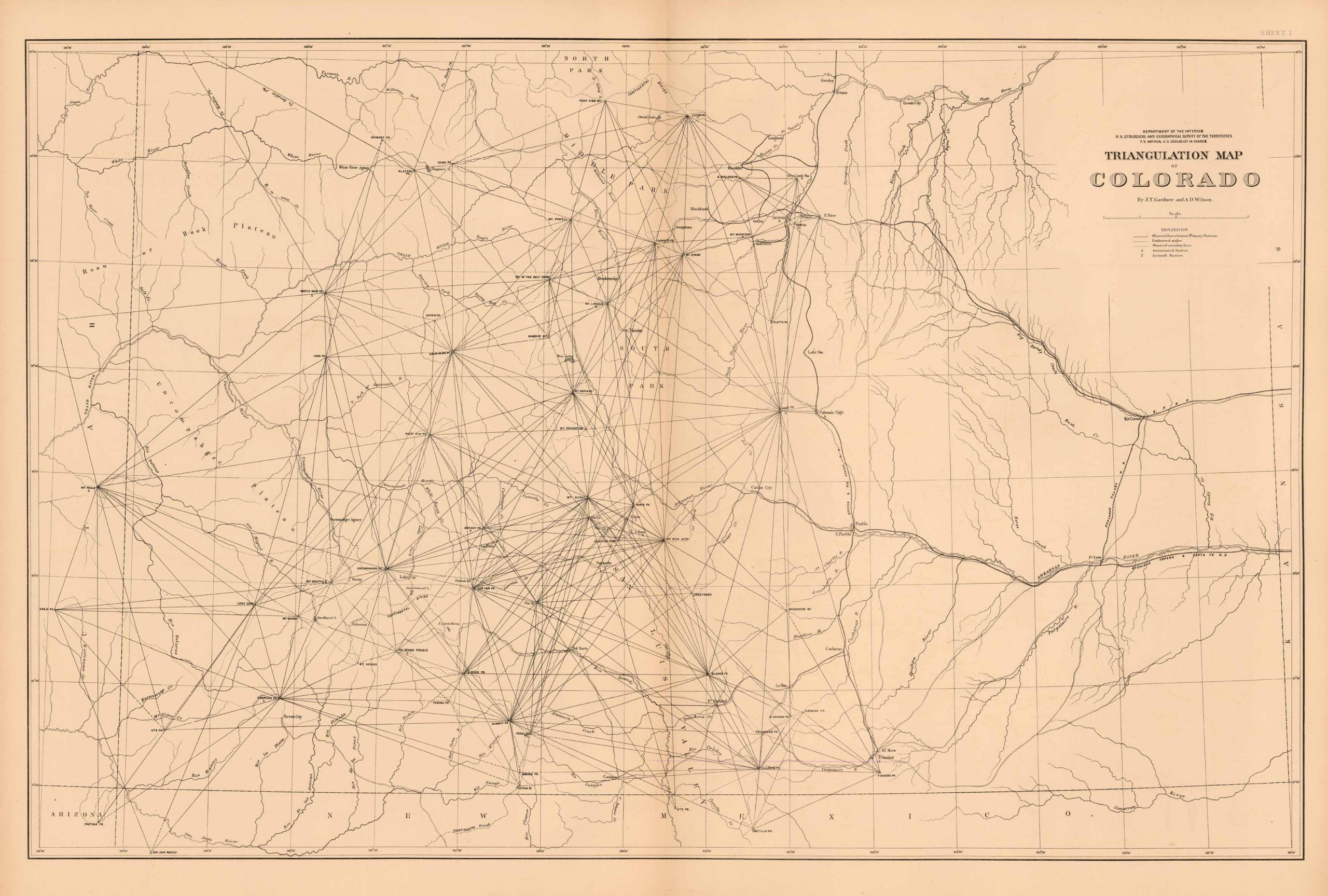
Triangulation Map of Colorado, 1881. Done by the Department of the Interior U.S. Geological and Geographical Survey of the Territories with F.V. Hayden as the U.S. Geologist in charge. This Triangulation Map comes with an explanation to detail what various line patterns and A & Z lettering indicate on the map. Creeks, rivers, towns, reservations and state lines are also shown.


