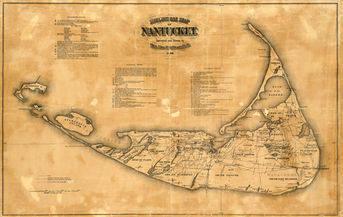
This historical map of Nantucket by F.C. Ewer shows the location as it was in 1869. It tracks changes to the island beginning in 1602 until 1836. The map identifies streets, railroads, ponds, hills, harbors, valleys, ancient villages, gardens, and more. The map records the island’s discovery, populations throughout the years, the island’s value and purchases, name changes, and the construction of various churches and school.
Additional information
| Weight | 0.25 lbs |
|---|---|
| Dimensions | 21 × 33 × 0.002 in |
Map Maker: Ewer, F. C.
Original Production Year: 1869
Original Production Year: 1869


