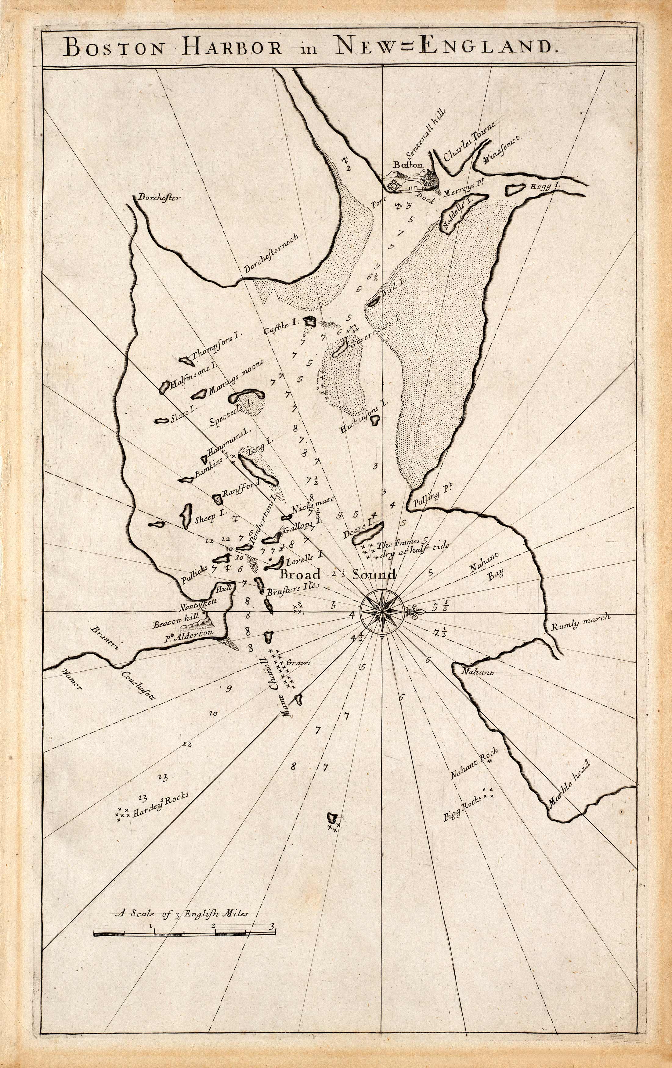
This nautical map by John Seller shows the Boston Harbor in New England in 1689. It features Charlestown, Marblehead, and the Broad Sound; the surrounding area of Boston is clearly marked with dozens of soundings, shoals, banks and other navigational hazards.
Additional information
| Weight | 0.25 lbs |
|---|---|
| Dimensions | 16.5 × 10 × 0.002 in |
Map Maker: John Seller
Original Production Year: 1689
Original Production Year: 1689


