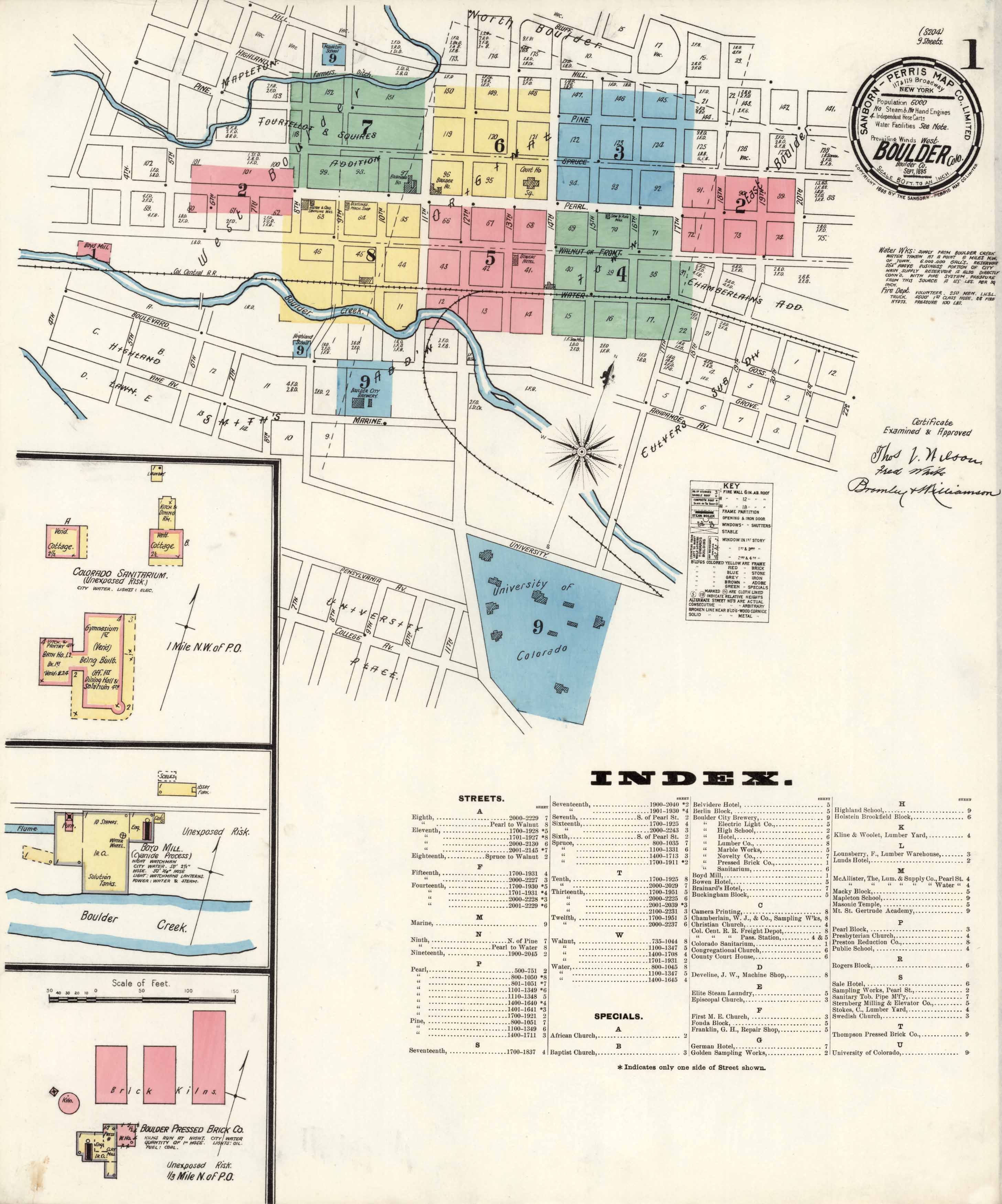
This map of Boulder in 1895 shows the University of Colorado, the Court House, Brainaird’s Hotel,Lunds Hotel, Boulder City Brewery, Camera Printing, and more. It identifies streets, creeks, railroad lines, churches, and mills. Over 20 locations are indexed. In the insets, the map highlights the Colorado Sanitarium, the Boyd Mill, and the Boulder Pressed Brick Co.
Additional information
| Weight | 0.25 lbs |
|---|---|
| Dimensions | 26 × 21 × 0.002 in |
Map Maker: Sanborn-Perris Map Co.
Original Production Year: 1895
Original Production Year: 1895


