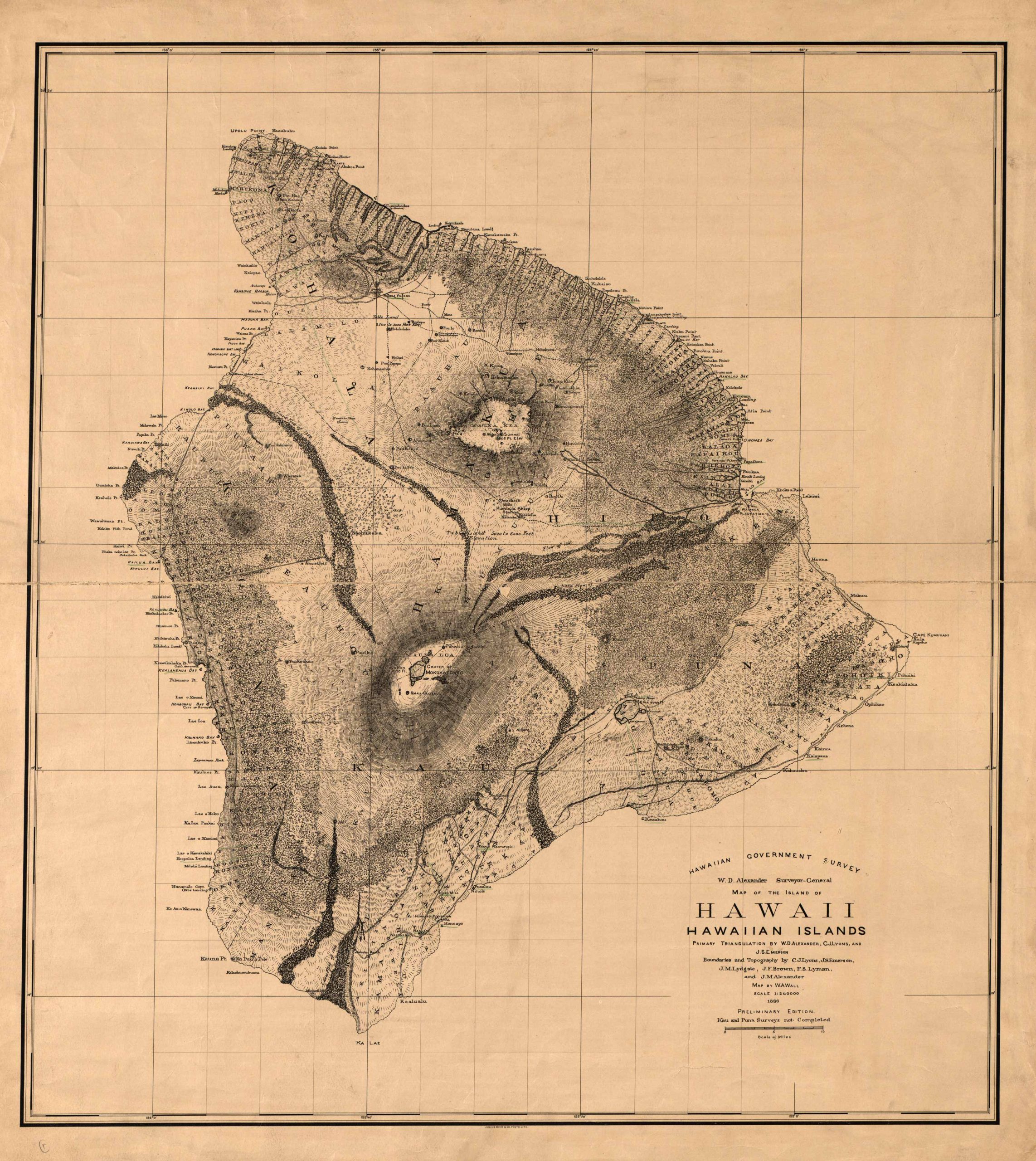
Map of the Island of Hawaii, Hawaiian Islands. Published by the Hawaiian Government Survey printed in 1886, W.D. Alexander Surveyor-General, map by W.A. Wall. This map of the big island of Hawaii depicts many different natural and man-made features such as bays, coves and shoreline names all along the coast of the island, elevation readings, harbors, towns and cities, craters such as Mukuaweoweo crater. This detailed map even shows small farms and many other features including: Kahuku Ranch, Honuapo Plantation, Kuana Pt., Kawaihae Harbor, Puako Bay among many, many others. Also featured are topographic lines.
Additional information
| Weight | 0.25 lbs |
|---|---|
| Dimensions | 31.25 × 27.75 × 0.002 in |
Town Name: HAWAII
Map Maker: W.A. Wall
Original Production Year: 1886
Artist: W.A. Wall
Year: 1886
Map Maker: W.A. Wall
Original Production Year: 1886
Artist: W.A. Wall
Year: 1886


