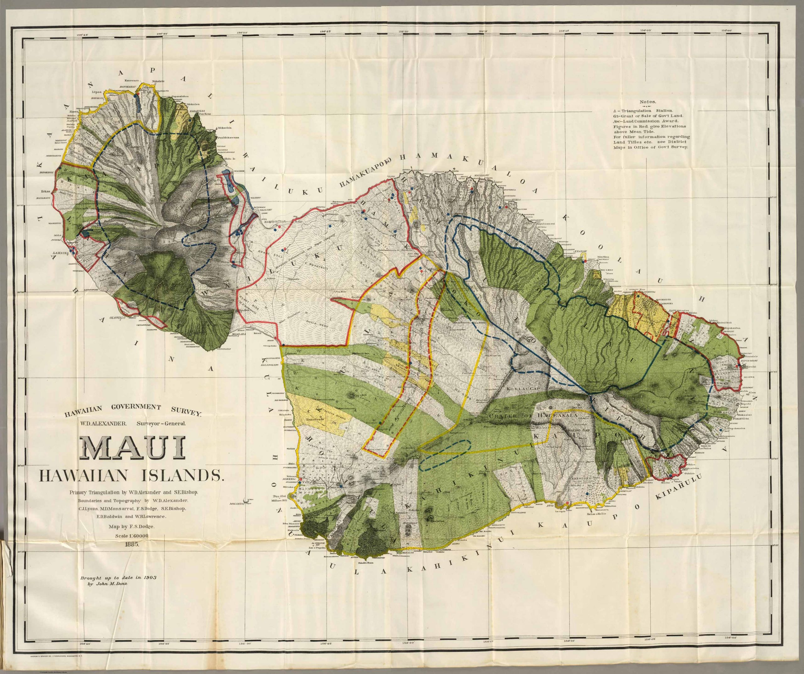
This is a map of the Maui in the Hawaiian Islands, by the Hawaiian Government Survey with W.D. Alexander as the Surveyor – General. Primary triangulation done by W.D. Alexander and S.E. Bishop. Boundaries and topography by W.D. Alexander, C.J. Lyons, M.D. Monsarrat, F.S. Dodge, S.E. Bishop, E.D. Baldwin and W.R. Lawrence. Map by F.S. Dodge. This map is scaled at 1:60,000 and was originally published in 1885, but was brought up to date in 1903 by John M. Donn. This beautiful, vibrant map showcases natural features such as peaks, valleys, bays and more. Some of these features include: Crater of Haleakala, Lahaina, Kahului, Hanakaoo, among many others.
Additional information
| Weight | 0.25 lbs |
|---|---|
| Dimensions | 48.9 × 58.4 × 0.002 in |
Town Name: MAUI
Map Maker: Hawaiian Government Survey
Original Production Year: 1903
Year: 1903
Map Maker: Hawaiian Government Survey
Original Production Year: 1903
Year: 1903


