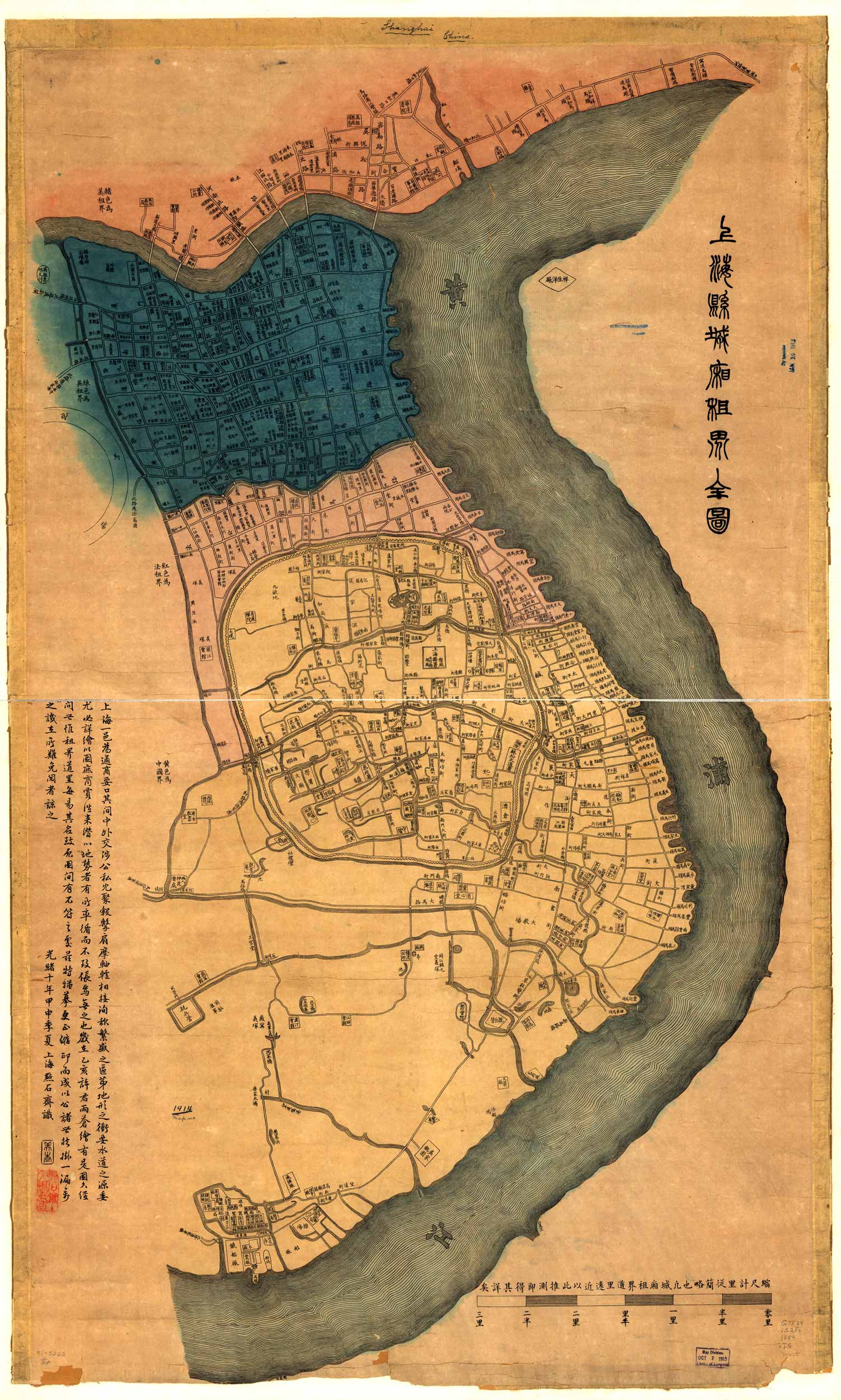
1884 revision of map originally drawn in 1875. Shows foreign concessions in Shanghai: Chinese area in yellow, French in red, British in blue, and American in orange. The most important provision of the 1842 pact between Great Britain and China was that Canton, Amoy, Foochow, Ningpo and Shanghai were to be opened to foreign trade, the Treaty Ports” as they became known. Following closely on the British action, the United States and France by treaties signed in 1844 acquired the right of trade by their nationals in the Treaty Ports. In its early development the boundaries of the original Foreign Settlement were the old Yang King Pang creek (now covered by Avenue Edward VII) to the South, the Whangpoo river on the East, what is now Peking Road on the North and, on the West, Barrier Road (now Honan Road), enclosing an area of 138 acres.”
Additional information
| Weight | 0.25 lbs |
|---|---|
| Dimensions | 14 × 24 × 0.002 in |
Map Maker: unknown
Original Production Year: 1875
Original Production Year: 1875


