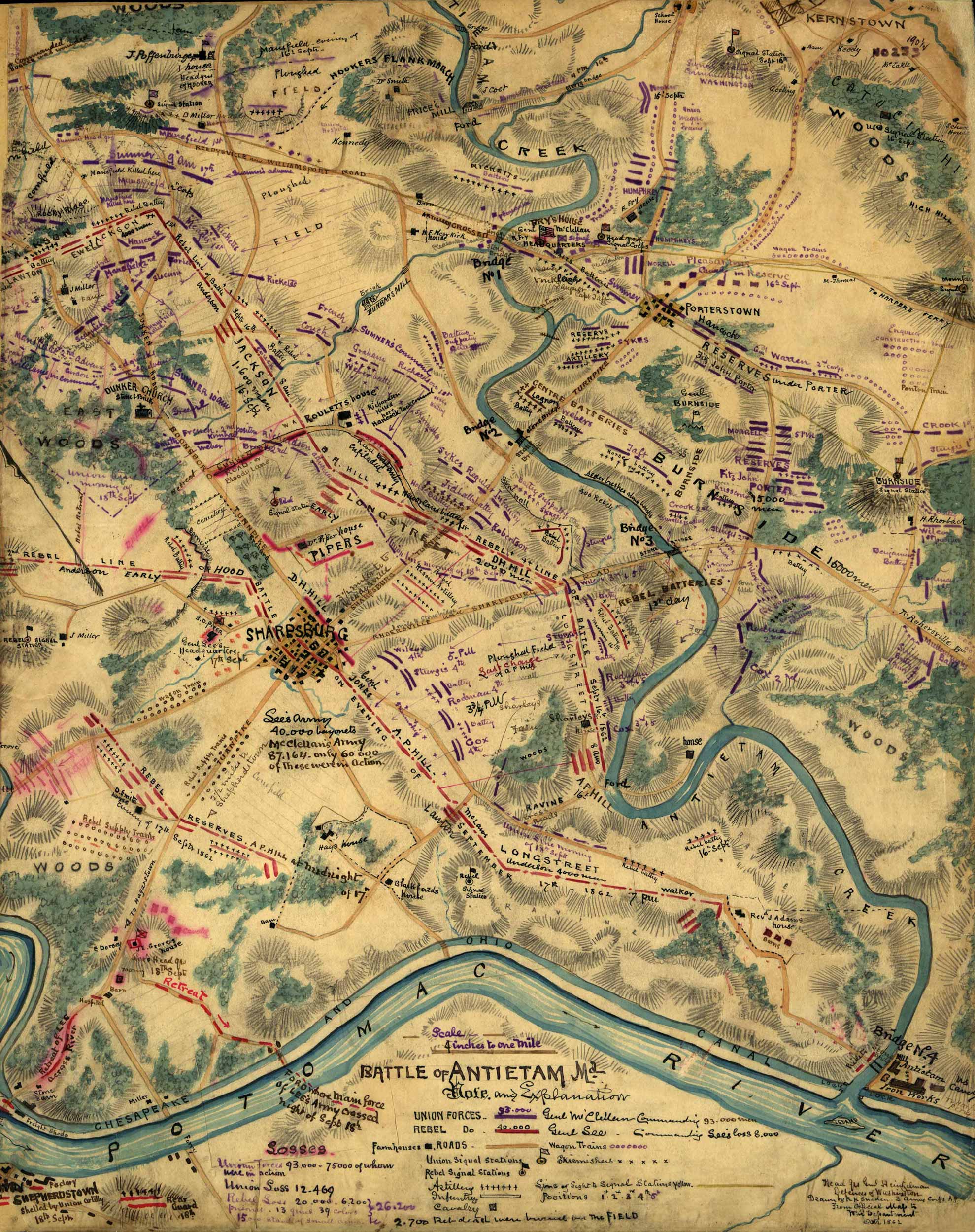
This map shows the location and details of the Battle of Antietam, near Sharpsburg, Maryland. The map was created by Robert Knox Sneden in 1862, the year the battle occurred. Includes depictions of the Chesapeake and Ohio Canal, the Potomac River, the Antietam Iron Works, and the Union and Confederate signal stations.
Additional information
| Weight | .25 lbs |
|---|---|
| Dimensions | 20 × 16 × .002 in |
Map Maker: Robert Knox Sneden
Original Production Year: 1862
Original Production Year: 1862


