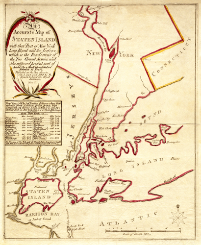
This Revolutionary War map of Staten Island shows parts of Long Island, Staten Island, Harlem, Rariton Bay, Connecticut, and Sandy Hook. It depicts light houses, bays, ferries, rivers, sounds, and more. Themap goes as far north as Anthony’s Nose and Thunder Hill, as far east as Connecticut, as far south as Rariton Bay, and as far west as Newark.
Additional information
| Weight | 0.25 lbs |
|---|---|
| Dimensions | 16.7 × 13.7 × 0.002 in |
Map Maker: Eynon, R.
Original Production Year: 1776
Original Production Year: 1776


