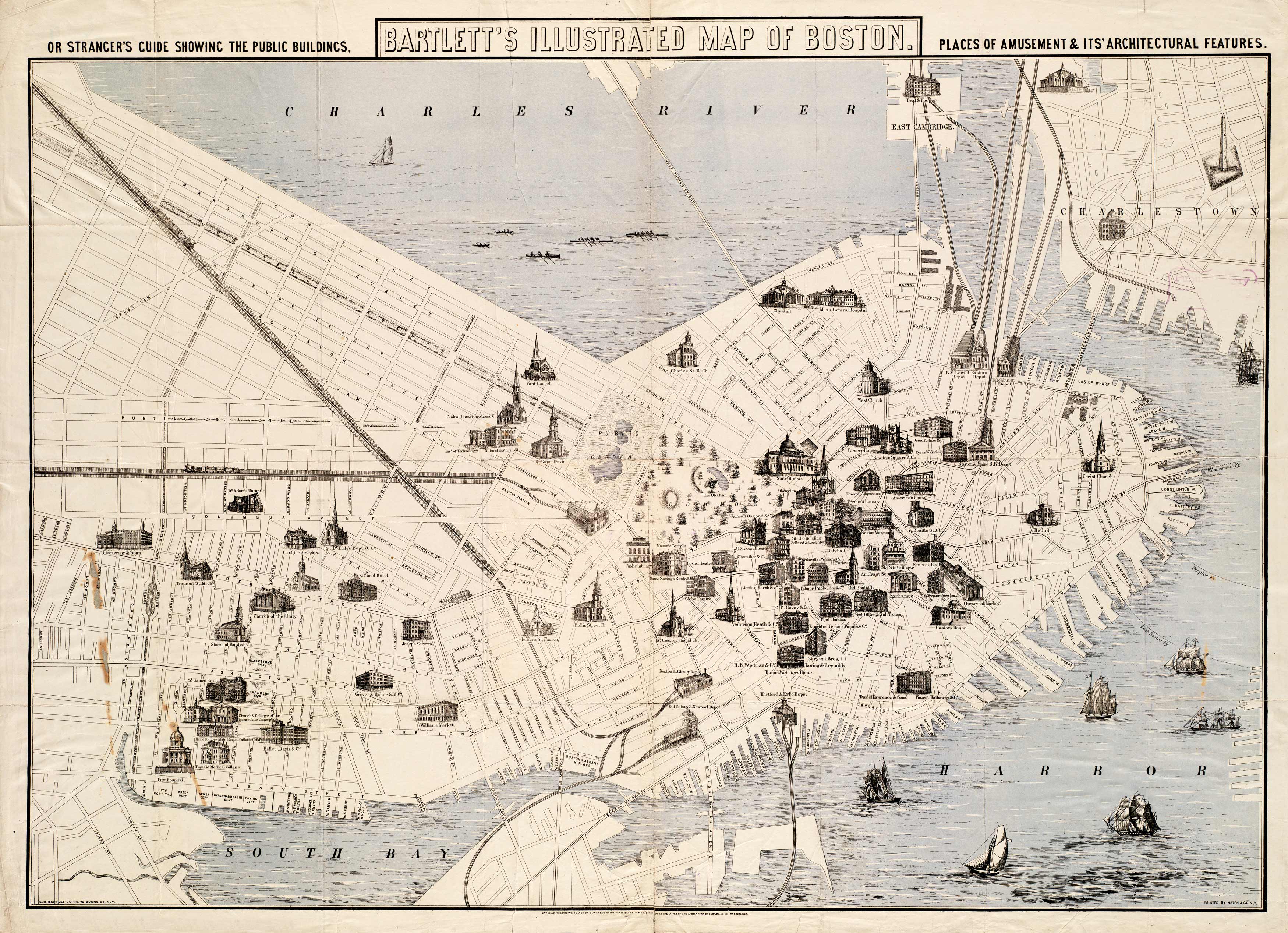
This illustrated map of Boston by George Bartlett provides a guide toplaces of amusement in the area. It shows the Hartford & Erie Depot, Daniel Webster’s Home, the Boston Theatre, the Revere House, the American House, Boston Museum, and goes on to show various hospitals, colleges, churches, and markets. This map identifies streets, railroad lines, bridges, wharves, bays, and the outer edges of Charlestown and Cambridge. It is rich with architecture and shows numerous ships coming and going from Boston Harbor.
Additional information
| Weight | 0.25 lbs |
|---|---|
| Dimensions | 23 × 32 × 0.002 in |
Map Maker: Bartlett, George Hartnell
Original Production Year: 1871
Original Production Year: 1871


