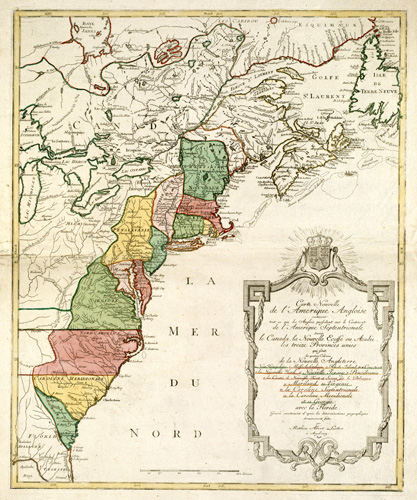
This 1776 map by Lotter shows the United States just before the American Revolutionary War. It shows as far south as Florida, as far west as Lake Superior in Canada, as far east as Newfoundland, and as far north as Canada. The map shows all of the Great Lakes but only half of Lake Superior. Native American settlements are also shown, particularly the Cherokees, Twictees, Mingos, and more. Pennsylvania’s borders include what is now present-day western New York, and Vermont has to be named a state. Extensive details of the areas surrounding Newfoundland and Nova Scotia are provided.
Additional information
| Weight | 0.25 lbs |
|---|---|
| Dimensions | 24 × 20 × 0.002 in |
Map Maker: Lotter, Matth�us Albrecht
Original Production Year: 1776
Original Production Year: 1776


