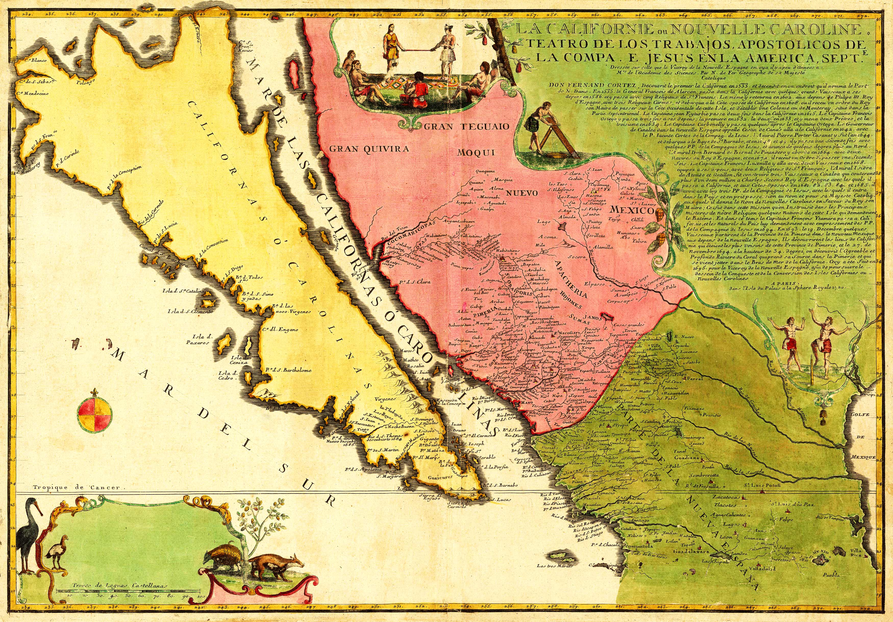
This 1720 map shows the Island of California” as known in 1720. The inset provides a history of California until 1694. Relief is shown pictorially. Some surrounding rivers, towns, mountains, and islands are named. The Gulf of Mexico is shown in the lower right corner. Artistic embellishments include a depiction of birds in the corner and Native Americans going about their day. Nicolas De Fer was a French geographer; his work was known to be more artistic than accurate, but he went on to produce over 600 maps as the official geographer for Philip V and Louis XIV, the kings of Spain and France. “
Additional information
| Weight | 0.25 lbs |
|---|---|
| Dimensions | 9.6 × 13.8 × 0.002 in |
Map Maker: Nicolas De Fer
Original Production Year: 1720
Original Production Year: 1720


