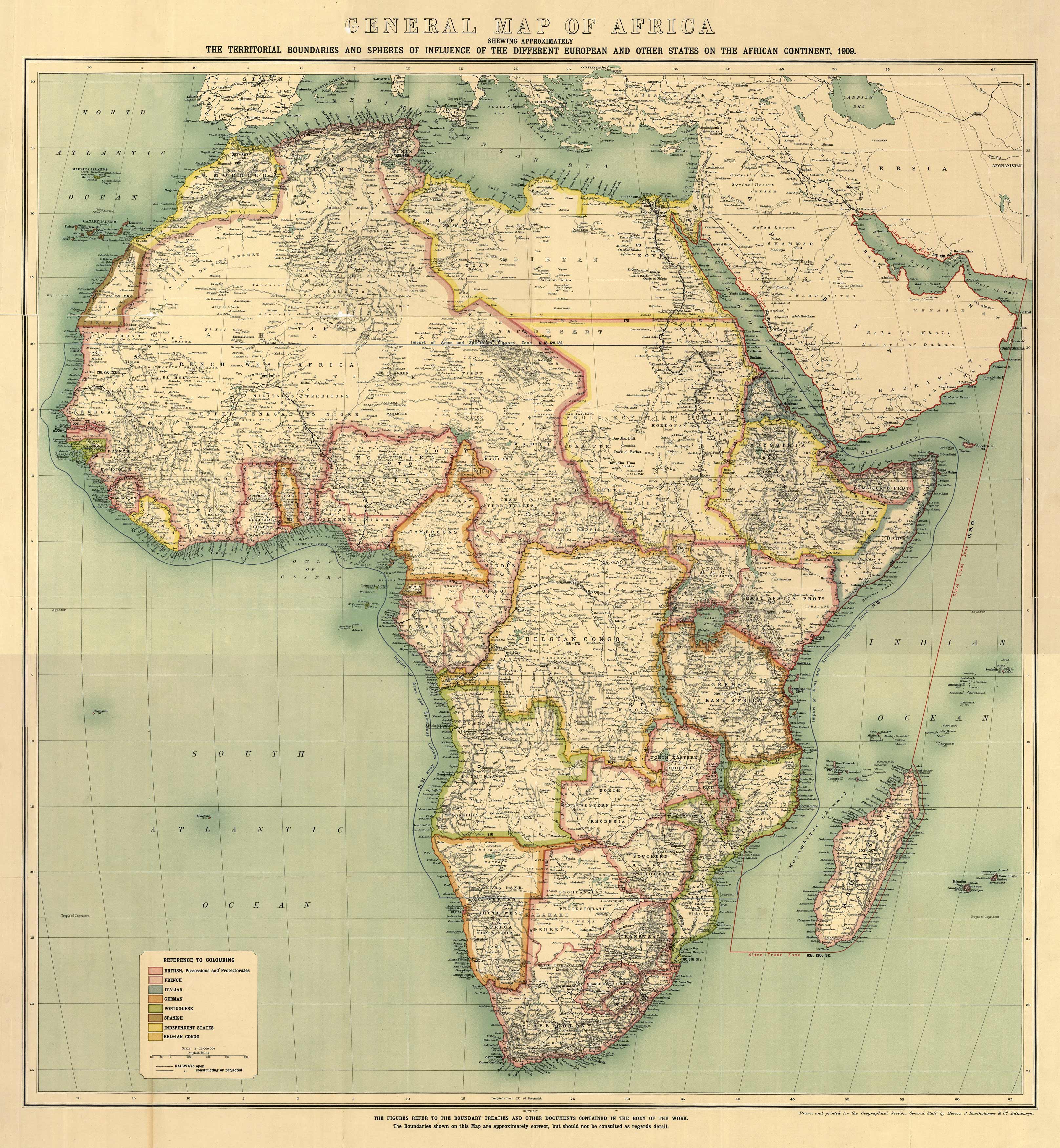
This map of Africa shows British, French, Italian, German, Portuguese, Spanish, and the Belgian Congo territories. It depicts railways, some jopen and others under construction. Some trade routes are shown: the Slave Trade is labeled in red, arms and liquor in blue. North of Africa, the map shows parts of Spain, Asia Minor, Persia, and Arabia. The Madeira Islands, the Canary Islands, and numerous other islands along the coast are labeled. Key cities, mountains, the Kalahari desert, and lakes are also shown.
Additional information
| Weight | 0.25 lbs |
|---|---|
| Dimensions | 32 × 30 × 0.002 in |
Map Maker: Hertslet, Edward
Original Production Year: 1909
Original Production Year: 1909


