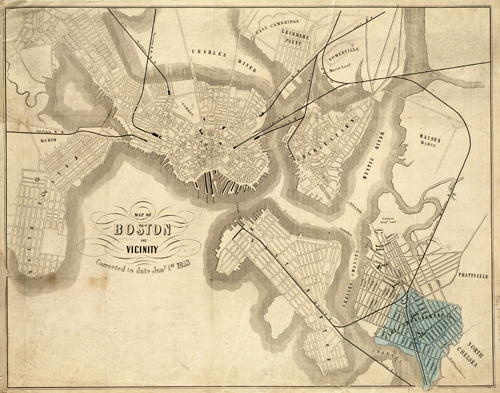
This map of Boston was made in 1853 by the Cary Improvement Company. It also shows Charlestown, Chelsea, and Cambridge. The map identifies neighborhood grids, railroad lines, bridges, ferry lines, wharves, and more.
Additional information
| Weight | 0.25 lbs |
|---|---|
| Dimensions | 12 × 15 × 0.002 in |
Map Maker: Cary Improvement Company
Original Production Year: 1853
Original Production Year: 1853


