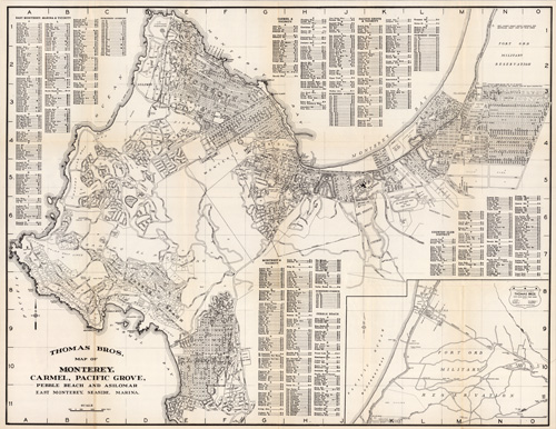
This 1949 map shows golf clubs, race tracks, airports, hotels, cemeteries, wharves, groves, schools, beaches, villages, city boundaries, the U.S. Lighthouse Reservation, the Fort Ord Military Reservation, numerous streets, lakes, highways, coves, and more. This map includes the cover imaged beneath the map. An interesting, extensively-detailed map!
Additional information
| Weight | 0.25 lbs |
|---|---|
| Dimensions | 21 × 27.5 × 0.002 in |
Map Maker: Thomas Brothers
Original Production Year: 1949
Original Production Year: 1949


