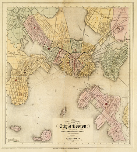
This map of Boston by E.P. Dutton & Co. shows Boston in 1861. The map goes on to include parts of Charlestown, Cambridge, and Roxbury. Castle Island and Governors Island are also shown. The map identifies streets, reservoirs, wharves, railroads, gardens, bridges, forts, navy yards, the hospital, depots, cemeteries, parks, and more.
Additional information
| Weight | 0.25 lbs |
|---|---|
| Dimensions | 21 × 19 × 0.002 in |
Map Maker: E.P. Dutton & Co.
Original Production Year: 1861
Original Production Year: 1861


