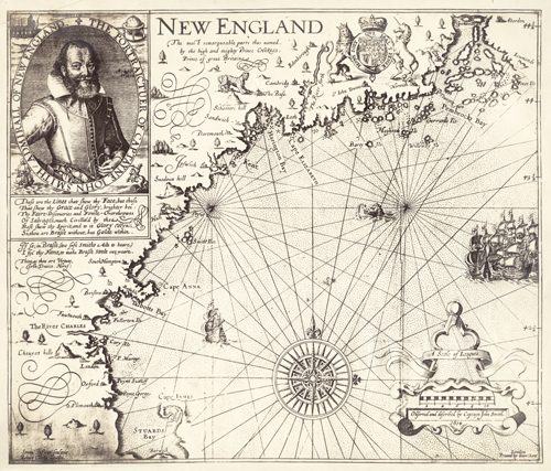
This 1616 map by John Smith shows the New England territory. Before this, in 1612, John Smith had published an extensive map of Virginia and the Chesapeake Bay areas; the map was used up to a century after its release due to its accuracy and detail. When he returned to New England, Smith found himself using 6-7 maps to navigate the region, each of them vastly different from each other. He then sought to create a map of New England that was on par with his map of Virginia. This is the first map to name Charleston. A few of the original names on this map are still in place, namely Plymouth, Charle’s River, and Cape Anne.
Additional information
| Weight | 0.25 lbs |
|---|---|
| Dimensions | 12 × 14 × 0.002 in |
Map Maker: John Smith
Original Production Year: 1616
Original Production Year: 1616


