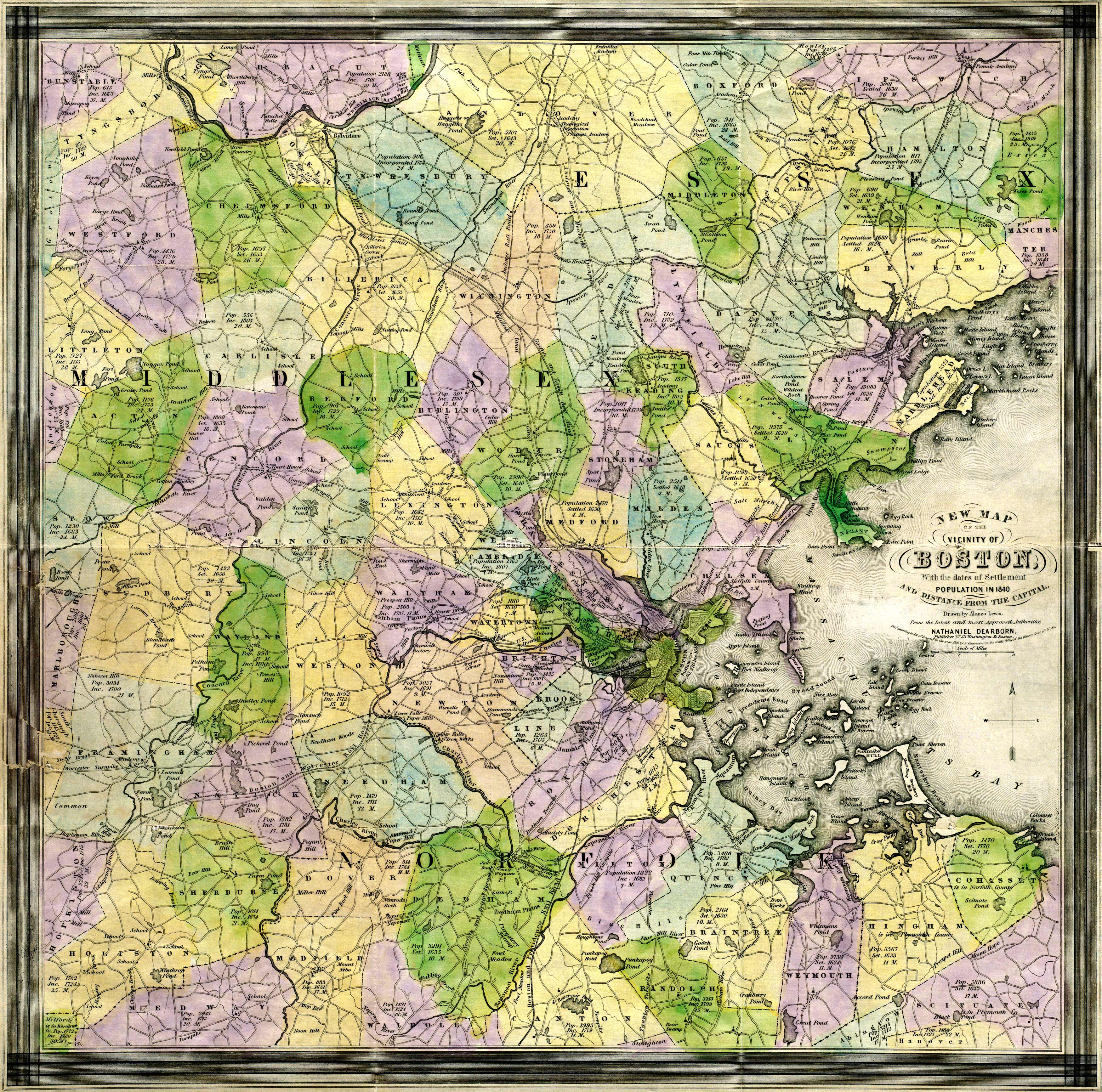
This map by Alonzo Lewis shows Boston as it was in 1841; it depicts Norfolk, Middlesex, and Essex. The map identifies roads, railroads, islands, rivers, schools, hills, and more. It shows populations and dates of settlements.
Additional information
| Weight | 0.25 lbs |
|---|---|
| Dimensions | 13 × 13 × 0.002 in |
Map Maker: Lewis, Alonzo
Original Production Year: 1841
Original Production Year: 1841


