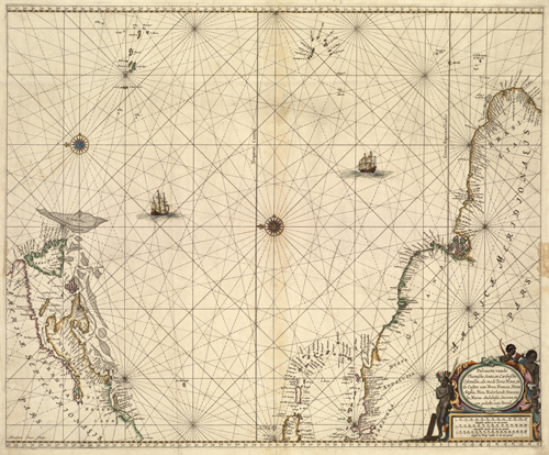
This map by Pieter Goos shows the New World in 1666. This map is in Dutch, with the north oriented to the left. The map shows what was New England, New Netherlands, and New Spain. It shows Puerto Rico, Aruba, and Quebec. Pieter Goos, son of cartographer Abraham Goos, published numerous nautical charts along famed cartographers Jodocus Hondius and Johannes Janssonius in Antwerp.
Additional information
| Weight | 0.25 lbs |
|---|---|
| Dimensions | 23 × 28 × 0.002 in |
Map Maker: Goos, Pieter
Original Production Year: 1666
Original Production Year: 1666


