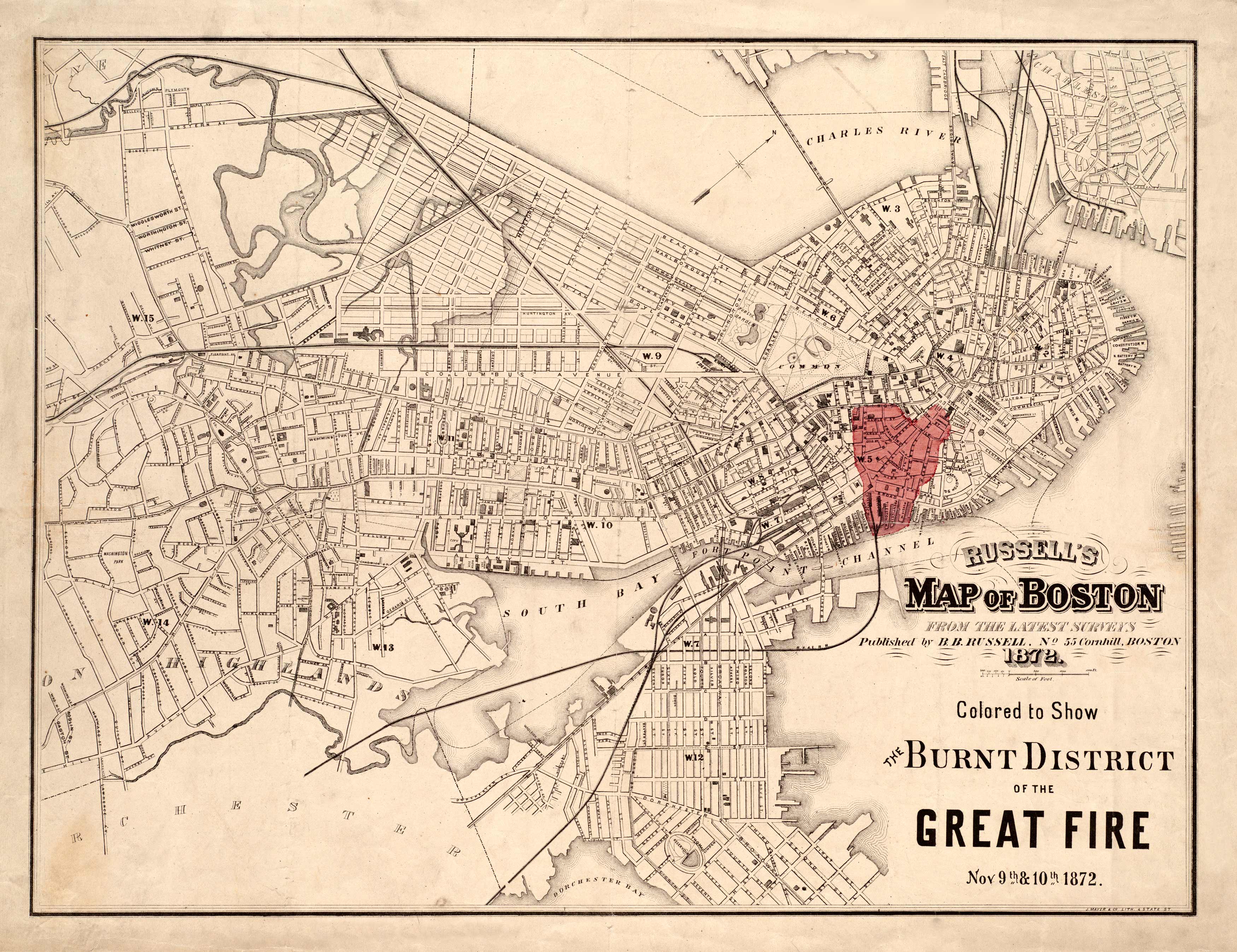
This 1872 map depicts the Great Fire in Boston.This was the largest fire to ever occur in Boston and is still one of the most expensive, costing about $74 million. At this time, building regulations weren’t enforced, and most buildings were insured above value so arson was common. The following reasons are why the fire was hard to control: buildings were made of wood, insufficient number of hydrants, gas line explosions, low pressure water pipes, and a horse flu immobilized most of the fire department’s horses, thus requiring equipment to be moved by foot. Many became unemployed and homeless following the fire, but the district was quickly rebuilt within 5 years.
Additional information
| Weight | 0.25 lbs |
|---|---|
| Dimensions | 21.4 × 27.8 × 0.002 in |
Map Maker: Russell, B. B.
Original Production Year: 1872
Original Production Year: 1872


