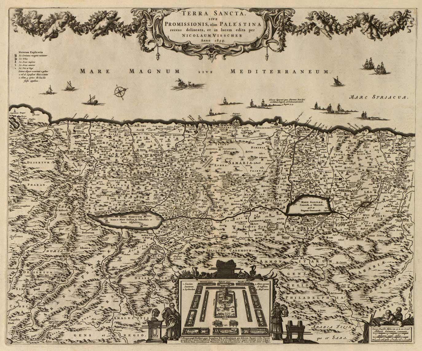
This gorgeous 1659 map by Visscher shows the Holy Land. The coast is spotted with a multitude of ships, including one bringing cedar for Solomon’s Temple, and another storm-tossed ship with a sea monster that possibly alludes to Jonah and the Whale. The Kishon (Cison) River connects Haifa Bay to the Sea of Galilee. At bottom is an inset of the encampment of the Tribes surrounding the Tabernacle, flanked by Moses and Aaron. The top of the map is embellished with an elaborate and elegant garland supported by cherub. The bottom right has the emblem of the fishermen showing both the father and the son.
Additional information
| Weight | 0.25 lbs |
|---|---|
| Dimensions | 15.5 × 19 × 0.002 in |
Map Maker: Nicolaus Visscher
Original Production Year: 1659
Original Production Year: 1659


