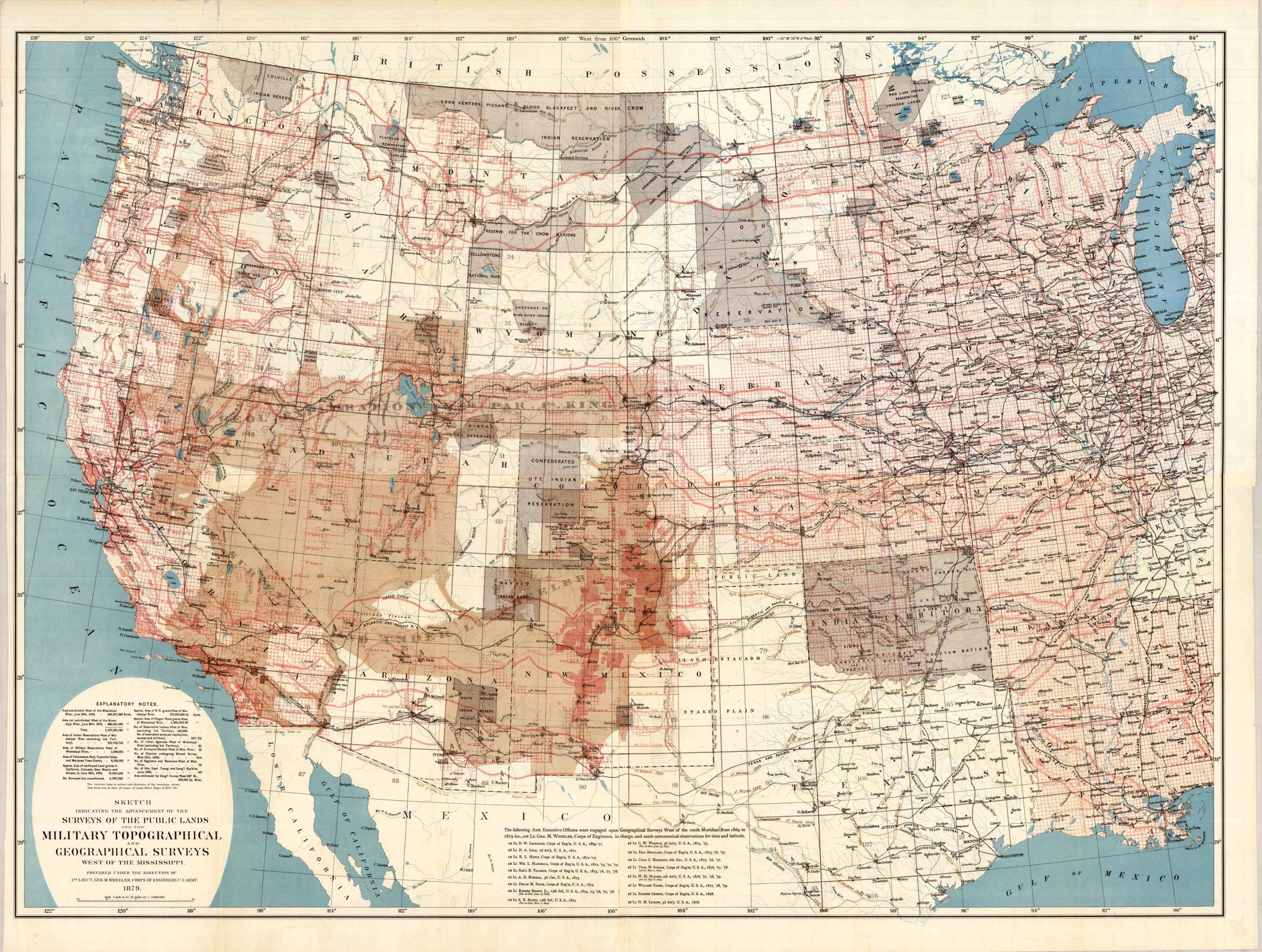
Sketch Indicating the Advancement of the Surveys of Public Lands and the Military Topographical and Geographical Surveys West of the Mississippi. This map was prepared under the direction of 1st. Lieut. Geo. M. Wheeler, Corps of Engineers U.S. Army. This map was originally published in 1879 and has a scale of 1:3,000,000. This map has beautiful vibrant colors and features roads, important buildings, the Pacific Ocean, Gulf of Mexico, Lake Michigan, Lake Superior, and part of the Gulf of California. Also featured are explanatory notes and a list of Asst. Executive Officers that were engaged upon geographical surveys West of the 100th Meridian. This beautiful map is great for anyone interested in the area, or who wants to learn more!
Additional information
| Weight | 0.25 lbs |
|---|---|
| Dimensions | 8.7 × 11.5 × 0.002 in |
Map Maker: Geo. M. Wheeler
Original Production Year: 1879
Year: 1879
Original Production Year: 1879
Year: 1879


