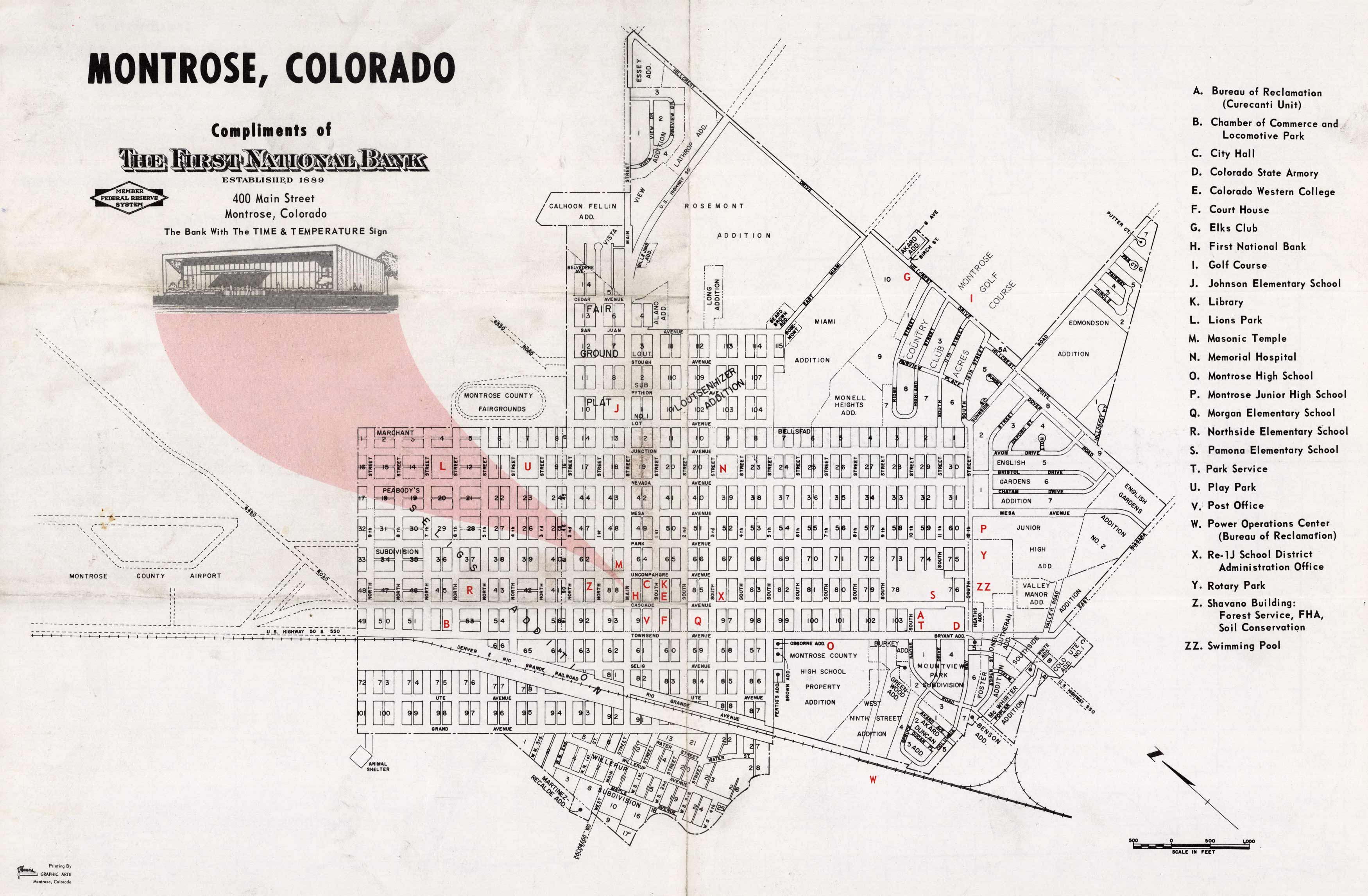
This reproduction mid-century map of Montrose, Colorado was created circa 1950. This unique map shows street names, the Denver and Rio Grande Railroad, and various points of interest.
Additional information
| Weight | 0.25 lbs |
|---|---|
| Dimensions | 11 × 17 × 0.002 in |
Map Maker: First National Bank of Montrose
Original Production Year: Ca. 1950
Original Production Year: Ca. 1950


