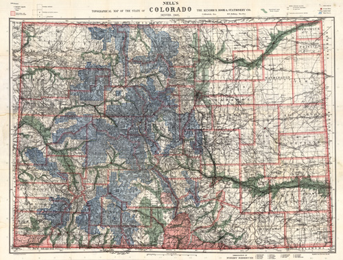
This 1907 map by Kendrick depicts the Colorado area. It shows individual counties, railroad lines, plateaus, hills, springs, trails, reservoirs, rivers, lakes, and more. The Nell series maps of Colorado were first issued in 1880, four years after Colorado became a state. They were released annually, each showing proposed and existing railroad lines, villages, post offices, and more. Mountain elevations are also given; relief is shown by hachures. Perhaps the most informative map of the state for its time, Kendrick continued making these maps until the early 1900’s.
Additional information
| Weight | 0.25 lbs |
|---|---|
| Dimensions | 28 × 39 × 0.002 in |
Map Maker: C.A. Kendrick
Original Production Year: 1907
Original Production Year: 1907


