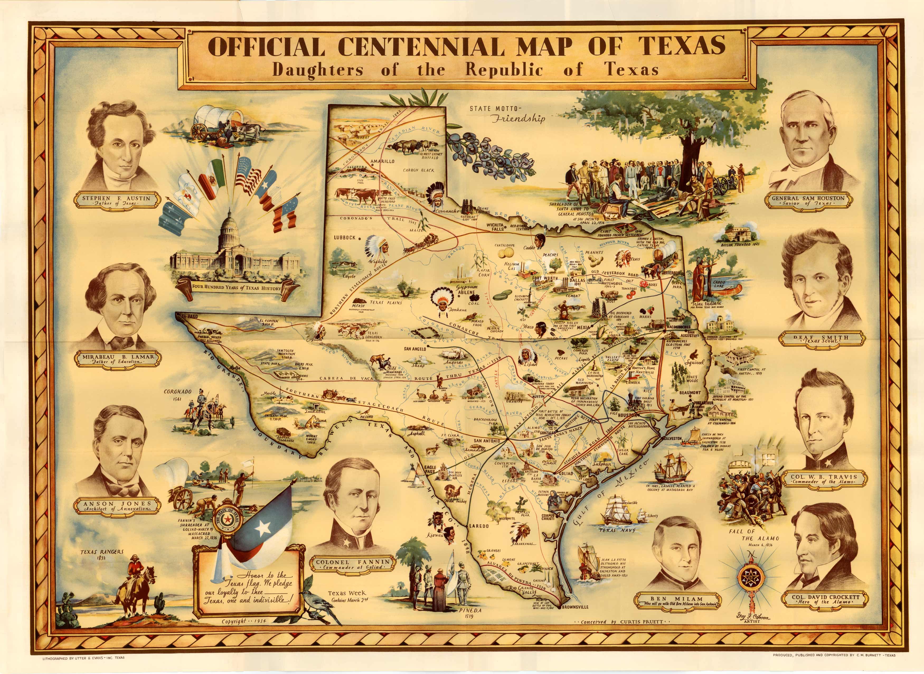
This detailed map, illustrated by Guy Cahoon and authored by Curtis Pruett, celebrates over 400 years of rich Texas history starting with Pineda in 1519. Key historic events captured include the Texas Revolution, Santa Anna’s surrender, and the Fall of the Alamo on March 6, 1936. The state is surrounded by portraits of the founding fathers of Texas including Stephen F Austin, Mirabeau Lamar, Anson Jones, Colonel Fannin, General Sam Houston, Deaf Smith, Col. W.B. Travis, Ben Milam and Col. David Crockett. Interspersed throughout the state are routes constructed by other explorers, Indian tribe locations, where staple crops grew, wild animal depictions, the first railroad, state parks, and more. The wagon trails captured include the Comanche Trail, Coronado’s Trail, Cattle Trail, San Antonio Trail, Southern Stagecoach Route, and the Northern Stagecoach Route among others others. Other highlights include the founding of Baylor University in 1845, Caddo Lake, Coronado 1541, Texas Rangers 1832, and First Capital at Columbia 1836.
Additional information
| Weight | 0.25 lbs |
|---|---|
| Dimensions | 17.5 × 24 × 0.002 in |
Map Maker: Guy Cahoon, Curtis Pruett
Original Production Year: 1936
Original Production Year: 1936


