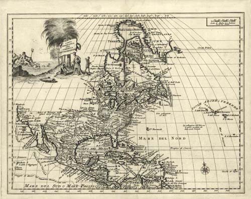
Carta geografica dell’ America settentrionale. Covers area including North America, Central America and the Caribbean Islands. Shows boundaries, cities and towns, forts, some trails, routes of exploration, and Indian villages and tribal territory. Appears in the author’s Atlante Novissimo (1740-50).
Additional information
| Weight | 0.25 lbs |
|---|---|
| Dimensions | 19 × 24 × 0.002 in |
Map Maker: Guillaume de Lisle'
Original Production Year: 1750
Original Production Year: 1750


