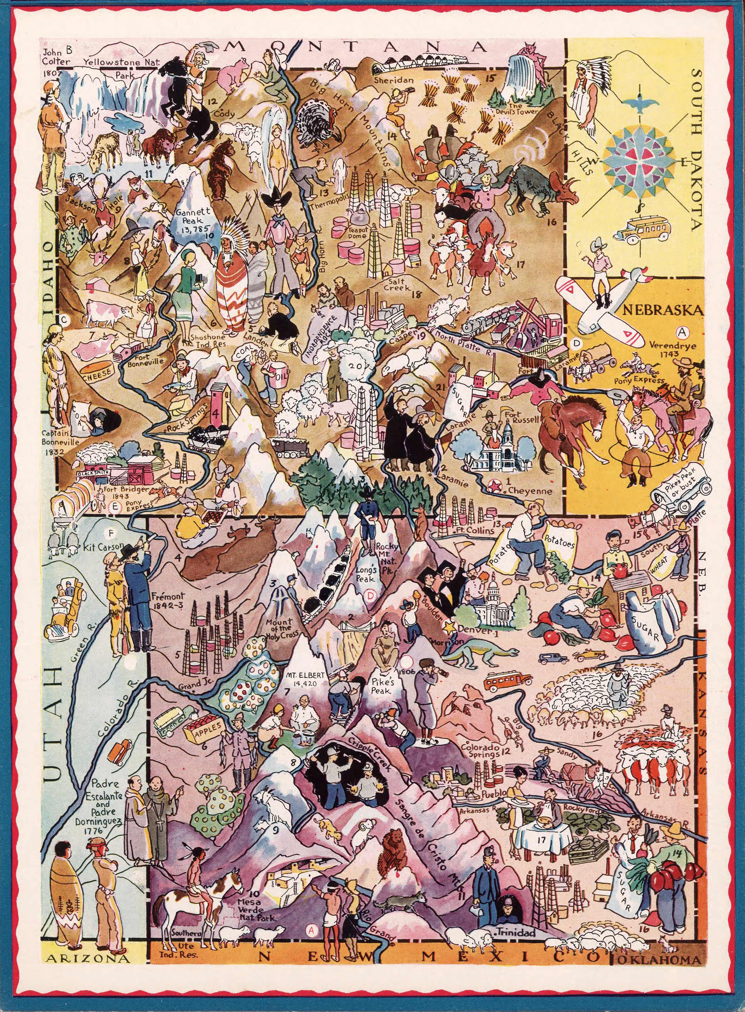
This pictorial map of Colorado was created by Berta Hader, an accomplished illustrator who has worked on dozens of children’s books and magazines. This map includes Colorado & Wyoming and portions of bordering states like Utah, Montana, South Dakota, Nebraska, Arizona, and New Mexico. Rocky Mountain National Park is one of the many illustrated places of interest on this map, including Longs Peak and Big Horn Mountain.
Additional information
| Weight | 0.25 lbs |
|---|---|
| Dimensions | 22 × 16 × 0.002 in |
Map Maker: Berta Hoerner Hader
Original Production Year: 1932
Original Production Year: 1932


