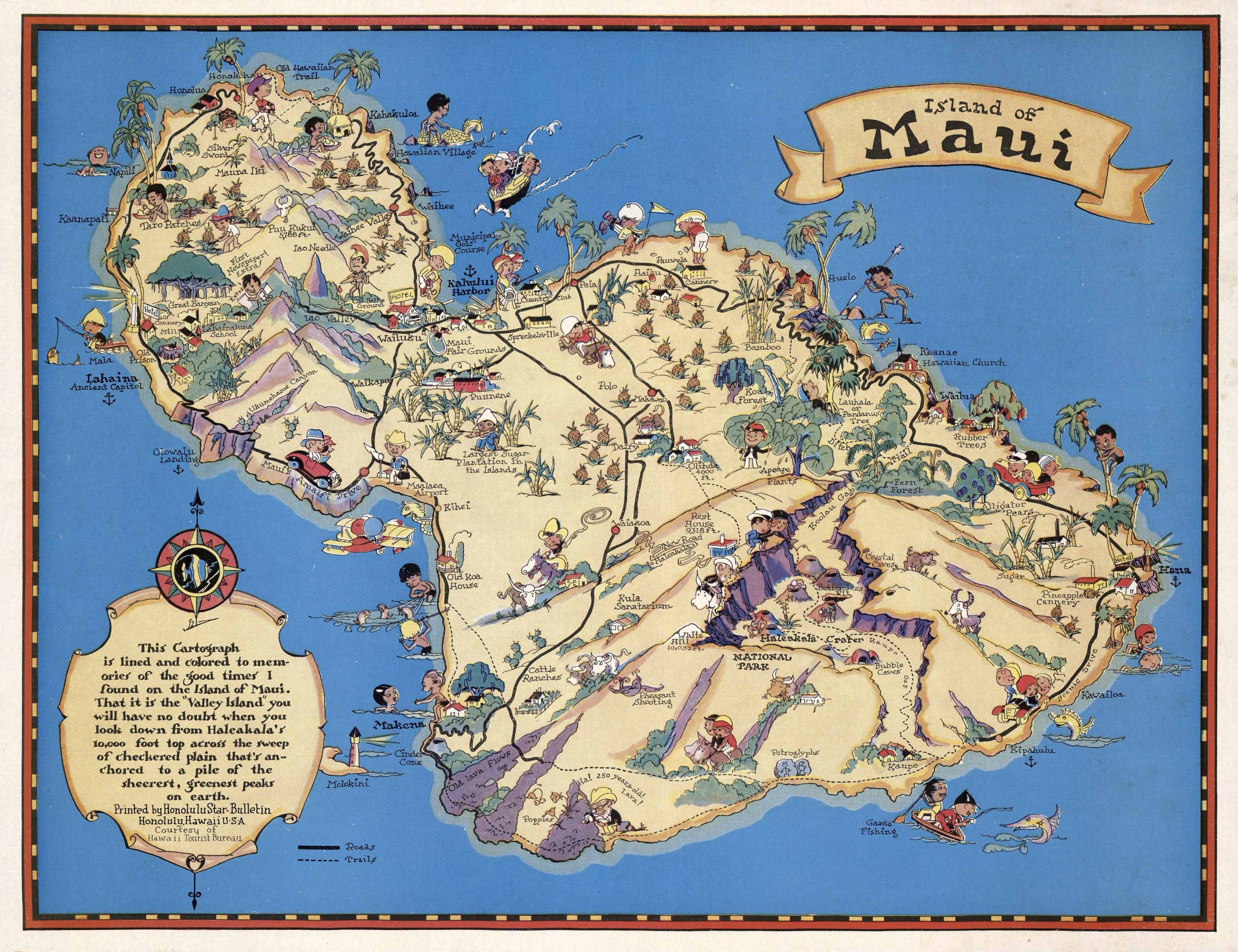
This is a map of the Island of Maui printed by the Honolulu Star-Bulletin Honolulu Hawaii, U.S.A, courtesy of the Hawaii Tourist Bureau. This map reads: This Cartograph is lined and colored to memories of the good times I found on the Island of Maui. That is The “Valley Island” you will have no doubt when you look down from Halcakala’s 10,000 ft top across the sweep of checkered plain that’s anchored to a pile of the sheerest, greenest peaks on earth. Featured are fun and vibrant pictorial representations of different aspects of the island such as: the Largest Sugar Plantation on the Island, Old Koa House, Kahului Harbor, Waihee Valley, Taro Patches and many more. This beautiful and dynamic map is perfect for anyone who has a love of the Island of Maui or who would like to get to know it better! This map was done by the famed cartographer, Ruth Taylor White.
Additional information
| Weight | 0.25 lbs |
|---|---|
| Dimensions | 43 × 55.3 × 0.002 in |
Town Name: MAUI
Map Maker: Ruth Taylor White
Original Production Year: 1935
Year: 1935
Map Maker: Ruth Taylor White
Original Production Year: 1935
Year: 1935


