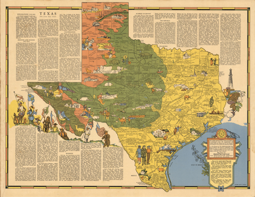
This is a pictorial and historical map of Texas, with complimentary notes and text. This map was published in 1939 by Robert T. Aitchison. It includes flags of six nations over Texas, counties and regions by terrain, vegetation type, missions, roads, the size, population, and categories of industry and agriculture by location. This map is unique with its colorful Texas history … The conquistador ; The Cowled Monk ; the colonist and the state builder, each doing his bit to build this beautiful state. It includes the state seal,state flower, and bird.
Additional information
| Weight | 0.25 lbs |
|---|---|
| Dimensions | 22 × 17 × 0.002 in |
Map Maker: Robert T. Aitchison
Original Production Year: 1939
Original Production Year: 1939


